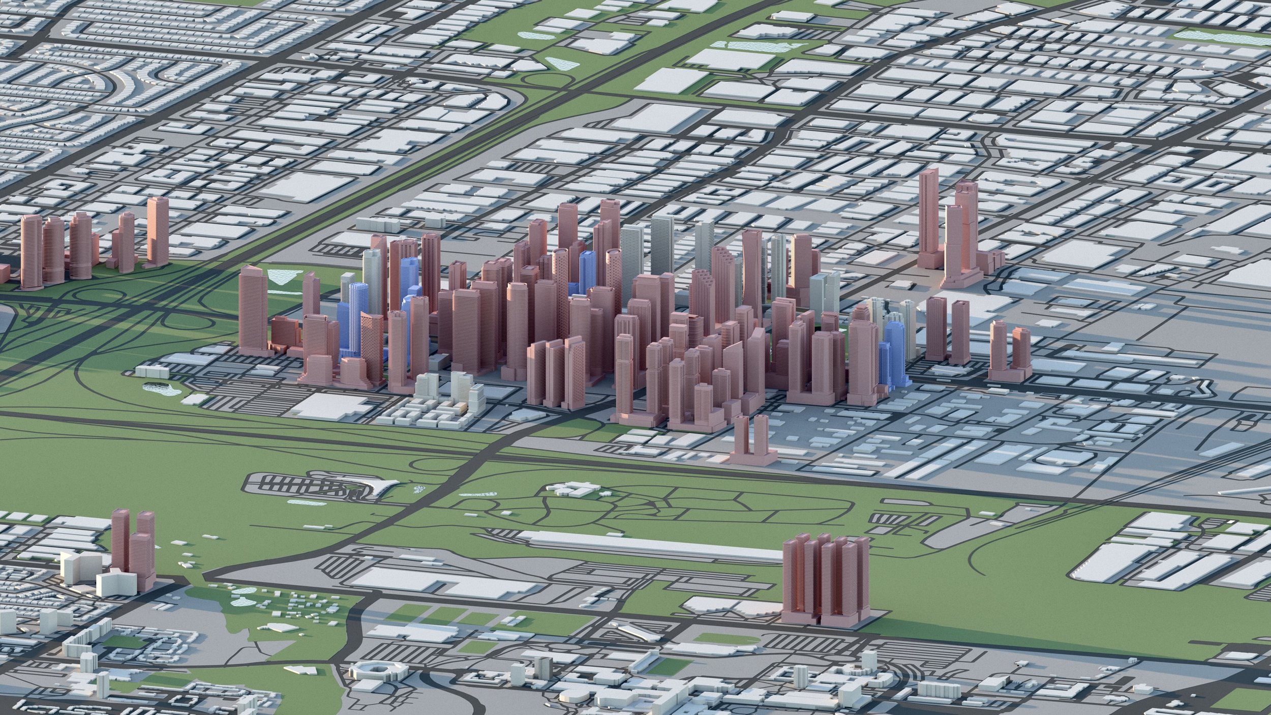
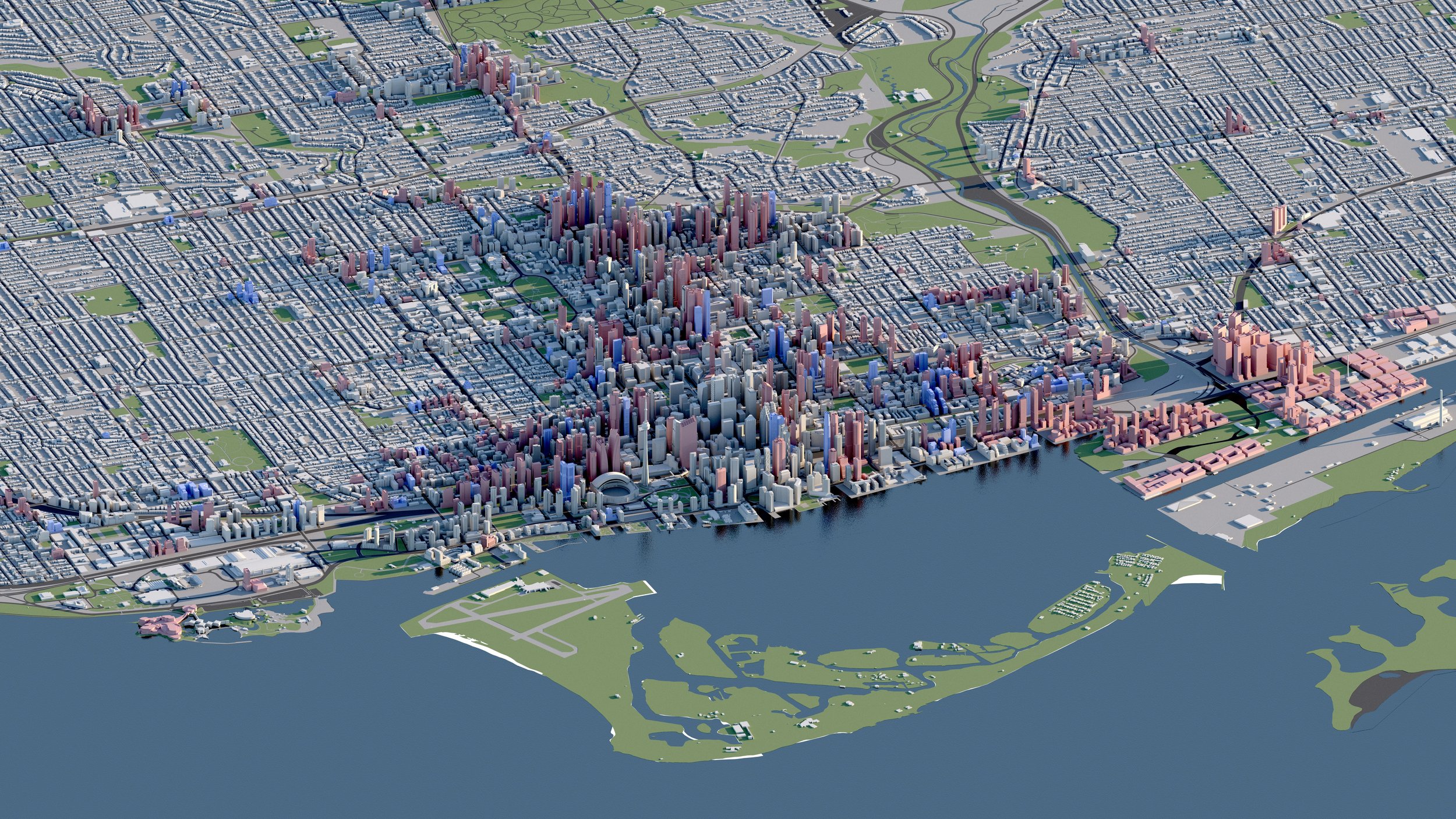
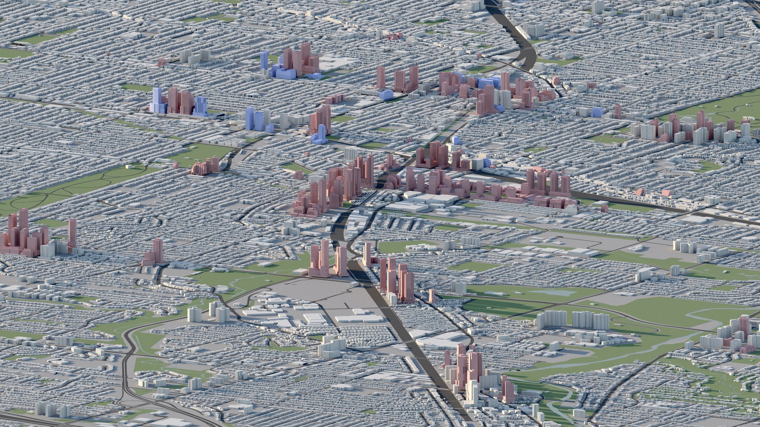
Midtown in Focus
Under Construction
Proposed / Approved
Water
Roads
Existing
Parks

New Neighbours
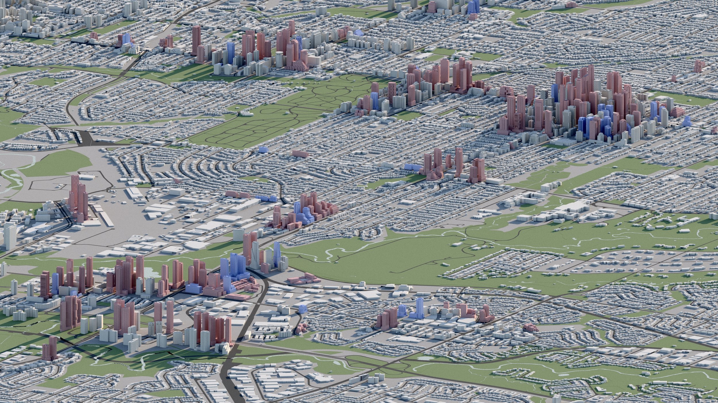
Development in Midtown has grown taller since the province of Ontario eliminated Toronto city council’s height limits in 2019. In the years since, developers have proposed 700 more storeys than would have been allowed previously. With Toronto's growing population, demand for housing, and a limited amount of land zoned for higher density, development has been forced upwards.
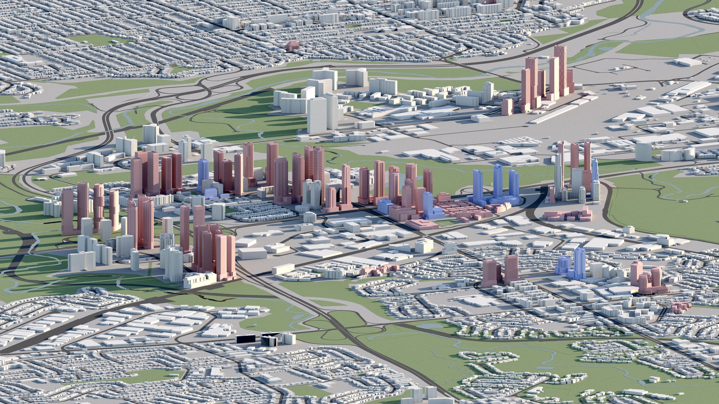
The majority of high-rises in Midtown are concentrated along three corridors bordering Yonge Street at Eglinton, Davisville, and St Clair, each with their own stations along the Yonge Street Line 1 Subway.

-
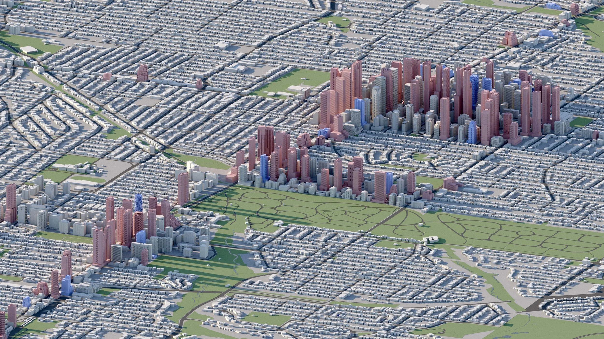
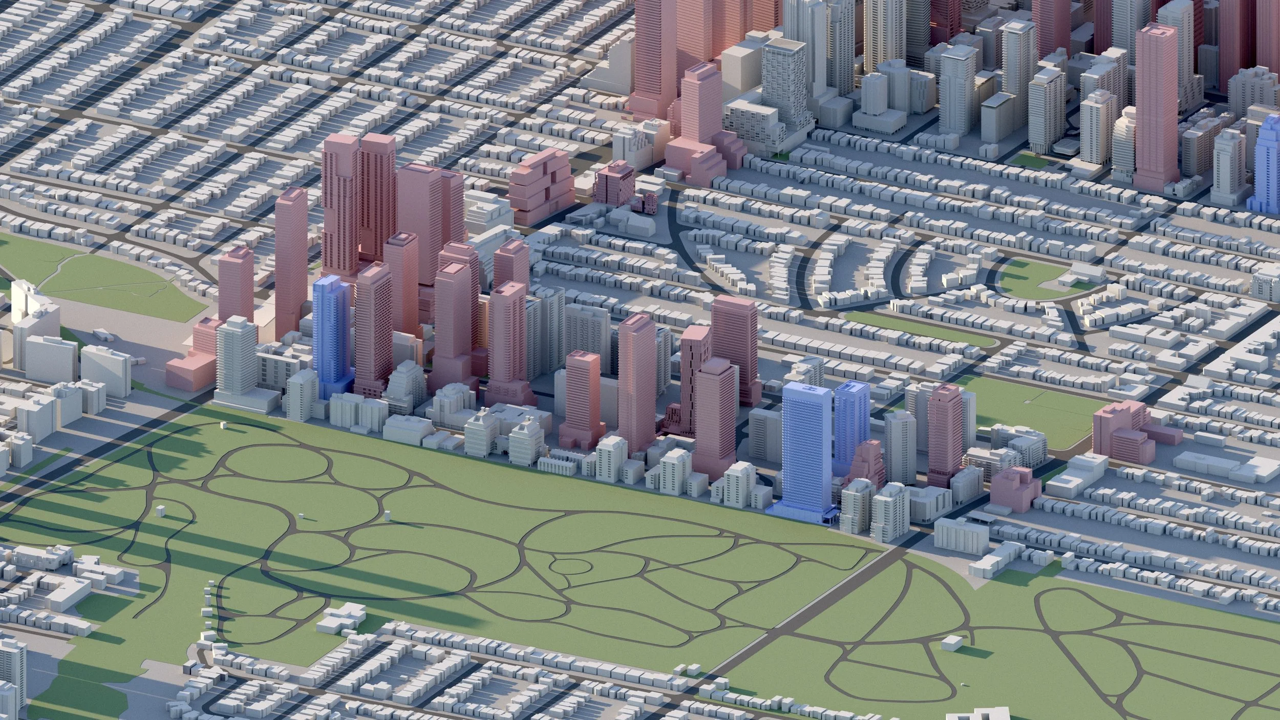
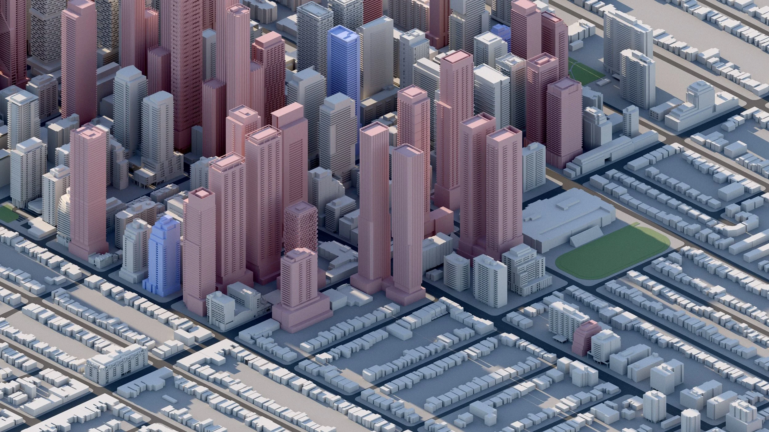
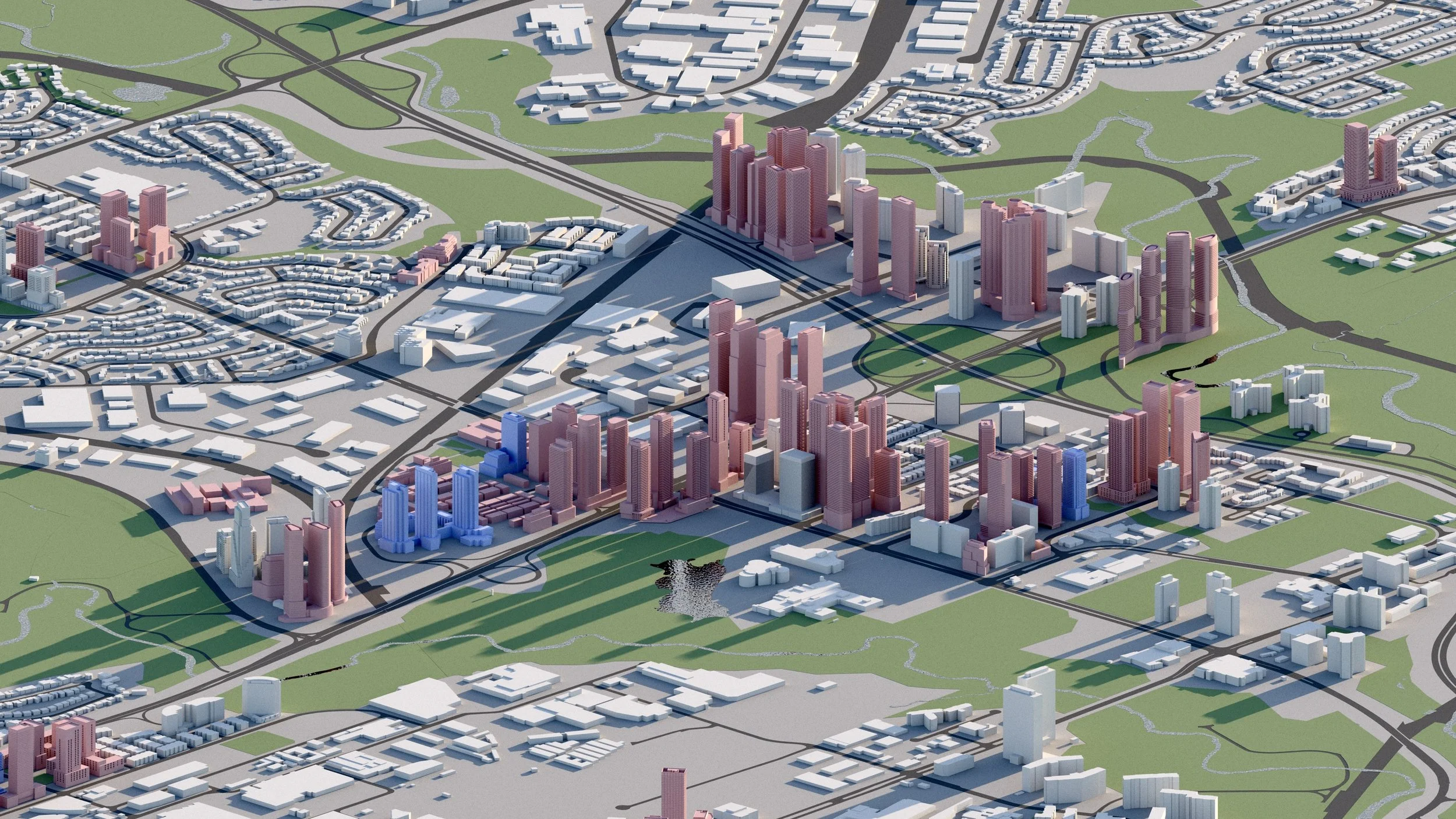
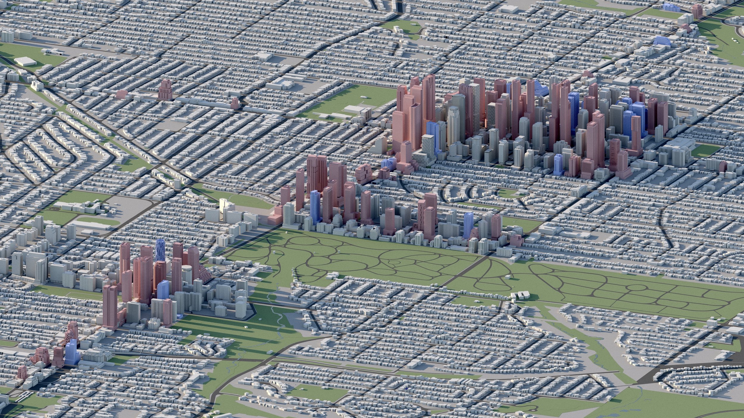
Yonge and Eglinton
25,000+ RESIDENTIAL UNITS
Yonge and Eglinton has seen a significant amount of development activity over the last decade. Density along this corridor has also progressed east toward Mount Pleasant Road and north to Erskine Avenue. This includes towers planned up to 70 storeys. -
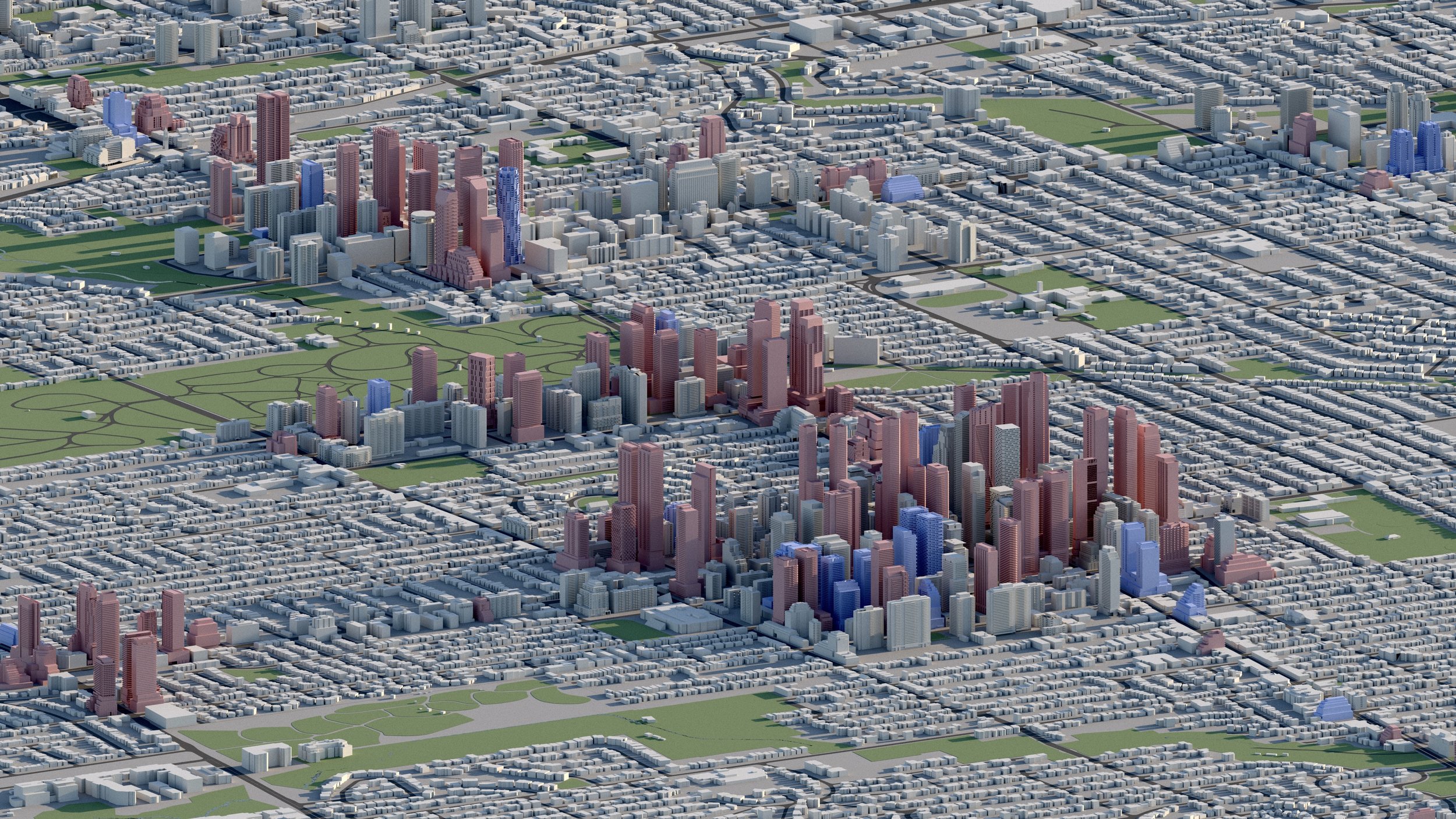
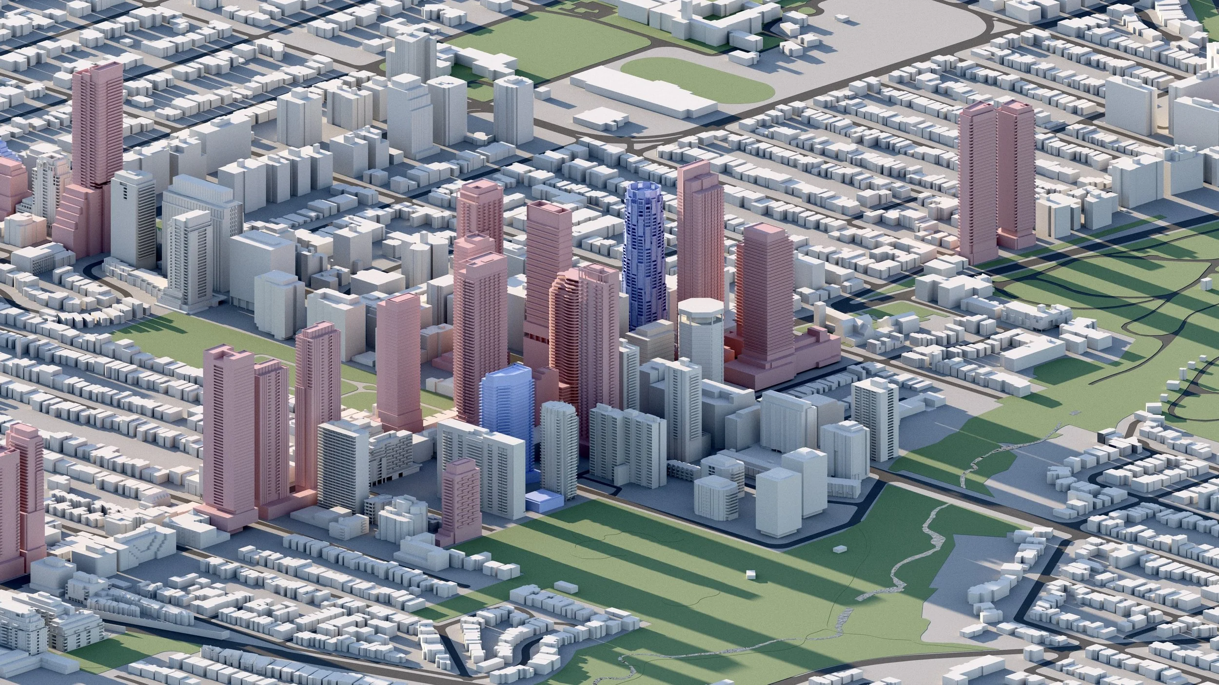
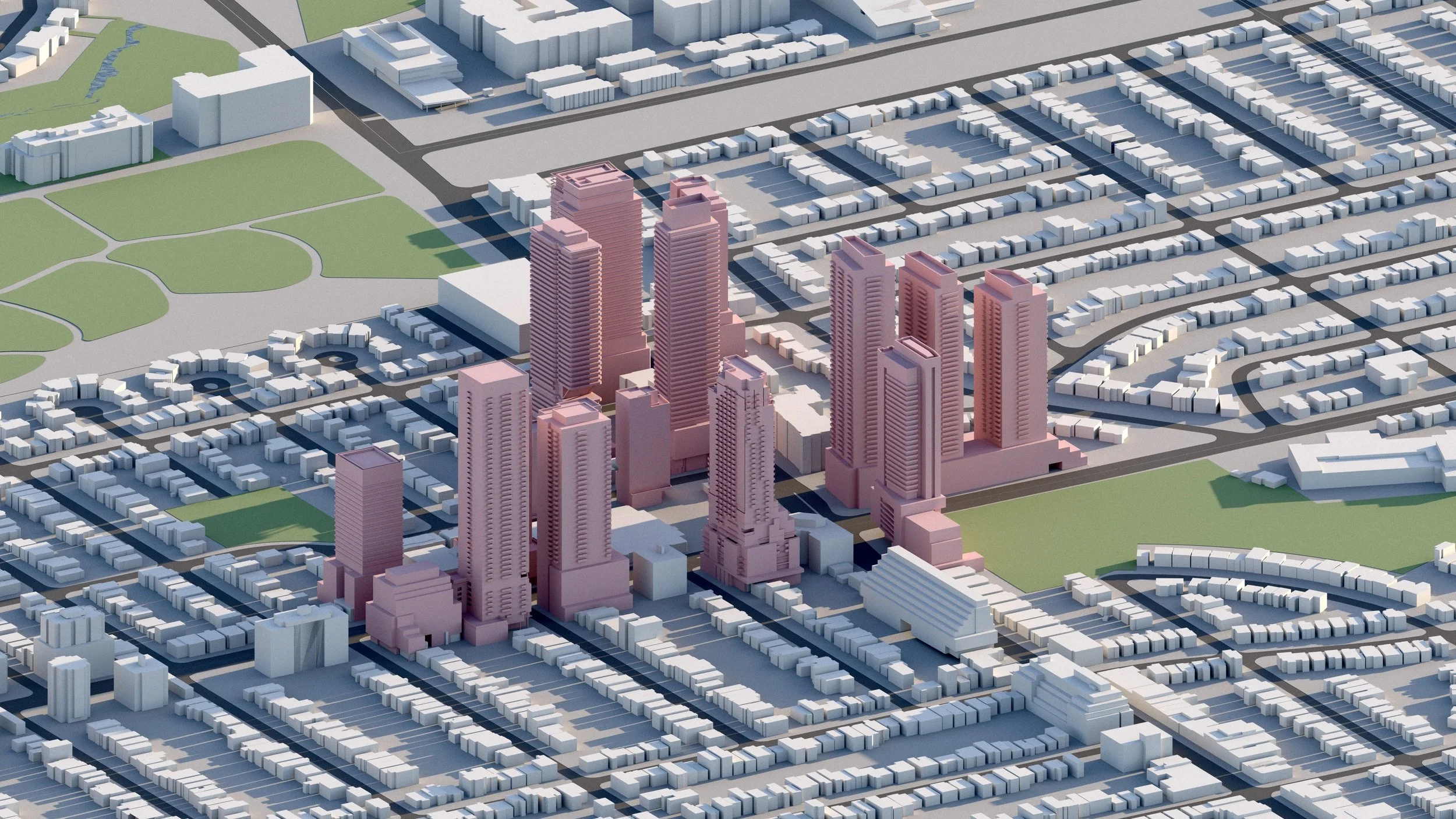
Yonge and Davisville
7,300 RESIDENTIAL UNITS
Over 7,300 residential units are currently in development within the Davisville Village / Yonge-Davisville neighbourhood, including towers up to 53 storeys. Nestled between existing apartment blocks, new towers will add considerable height and density to the area. -
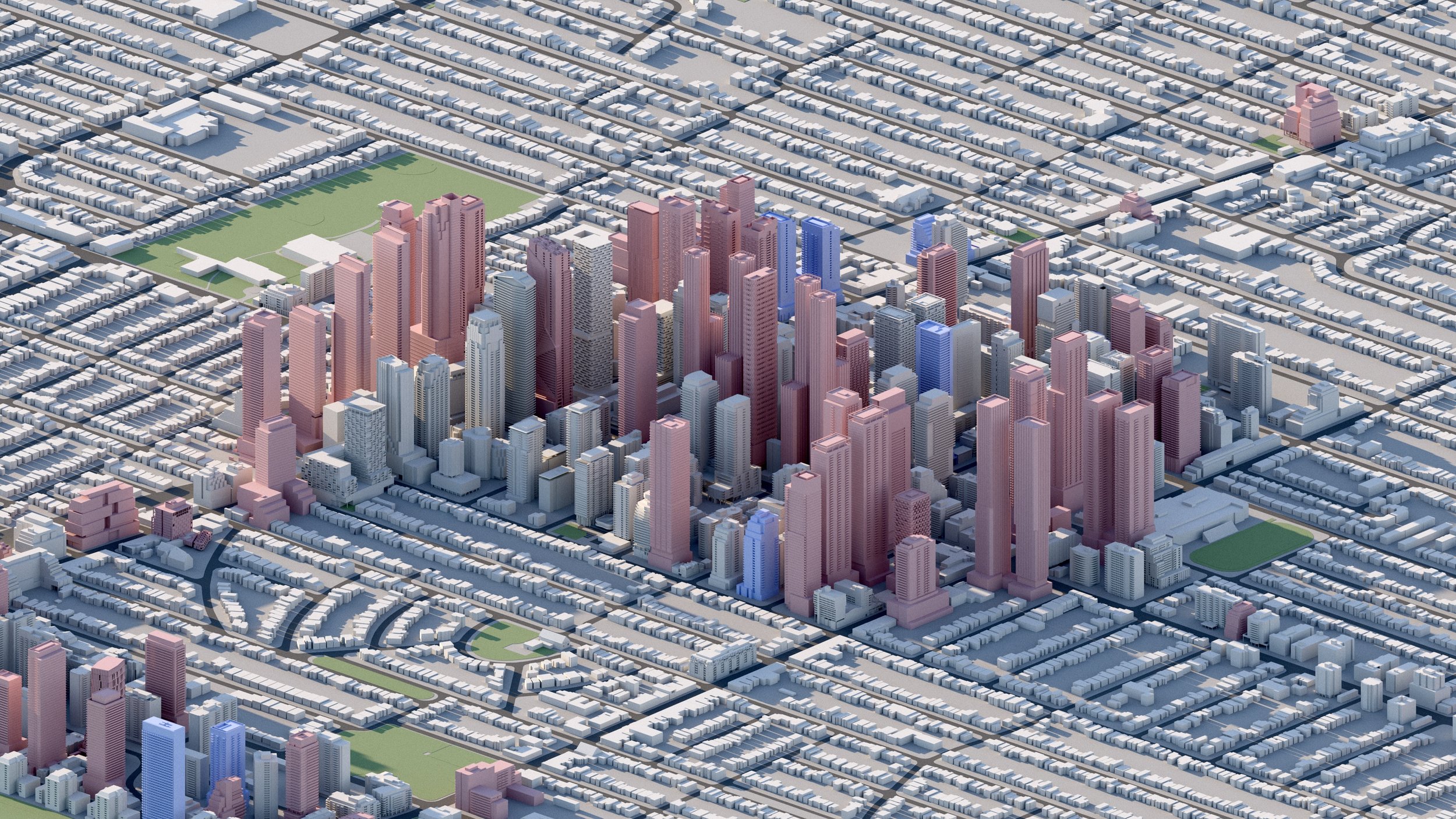
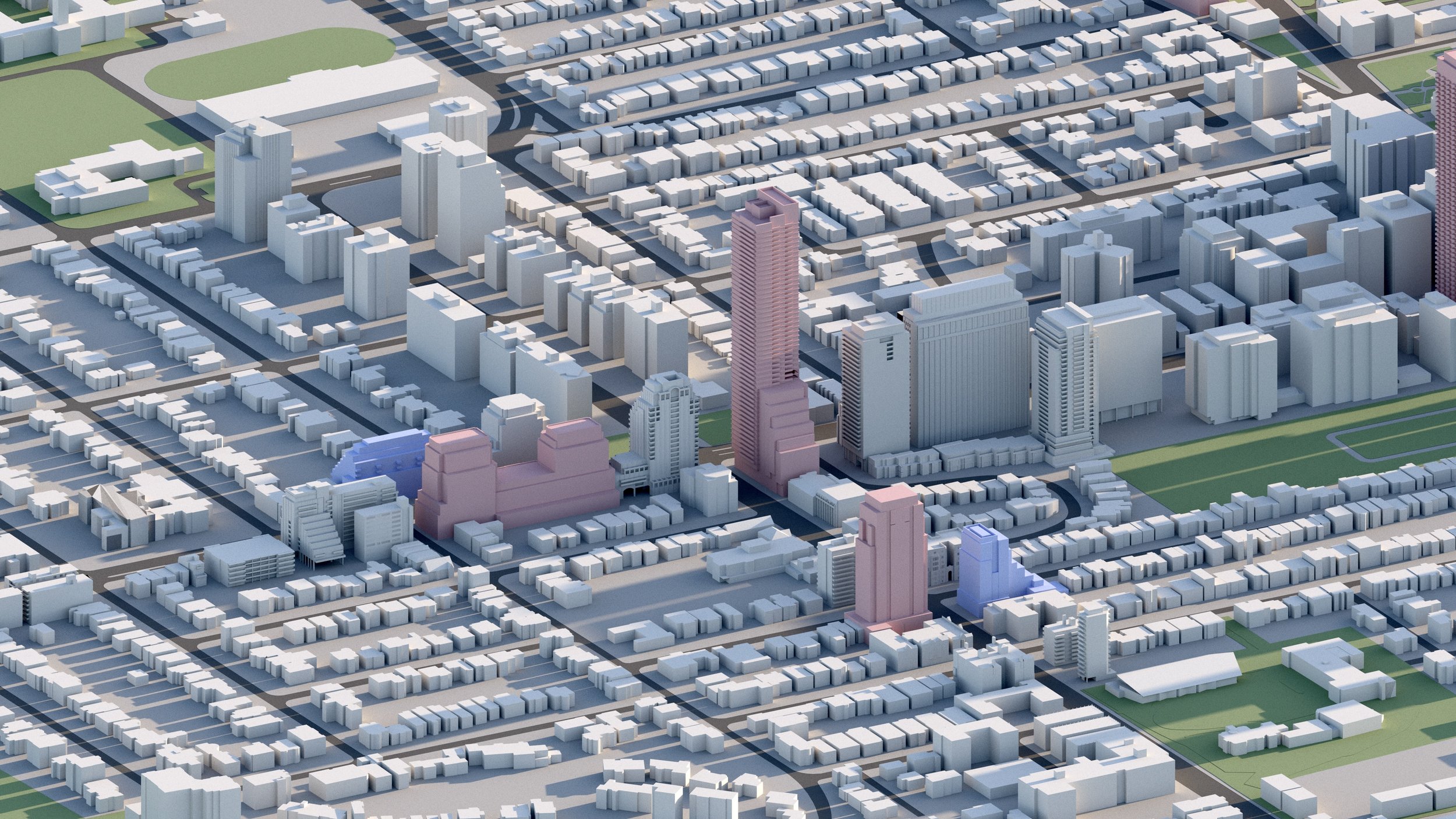
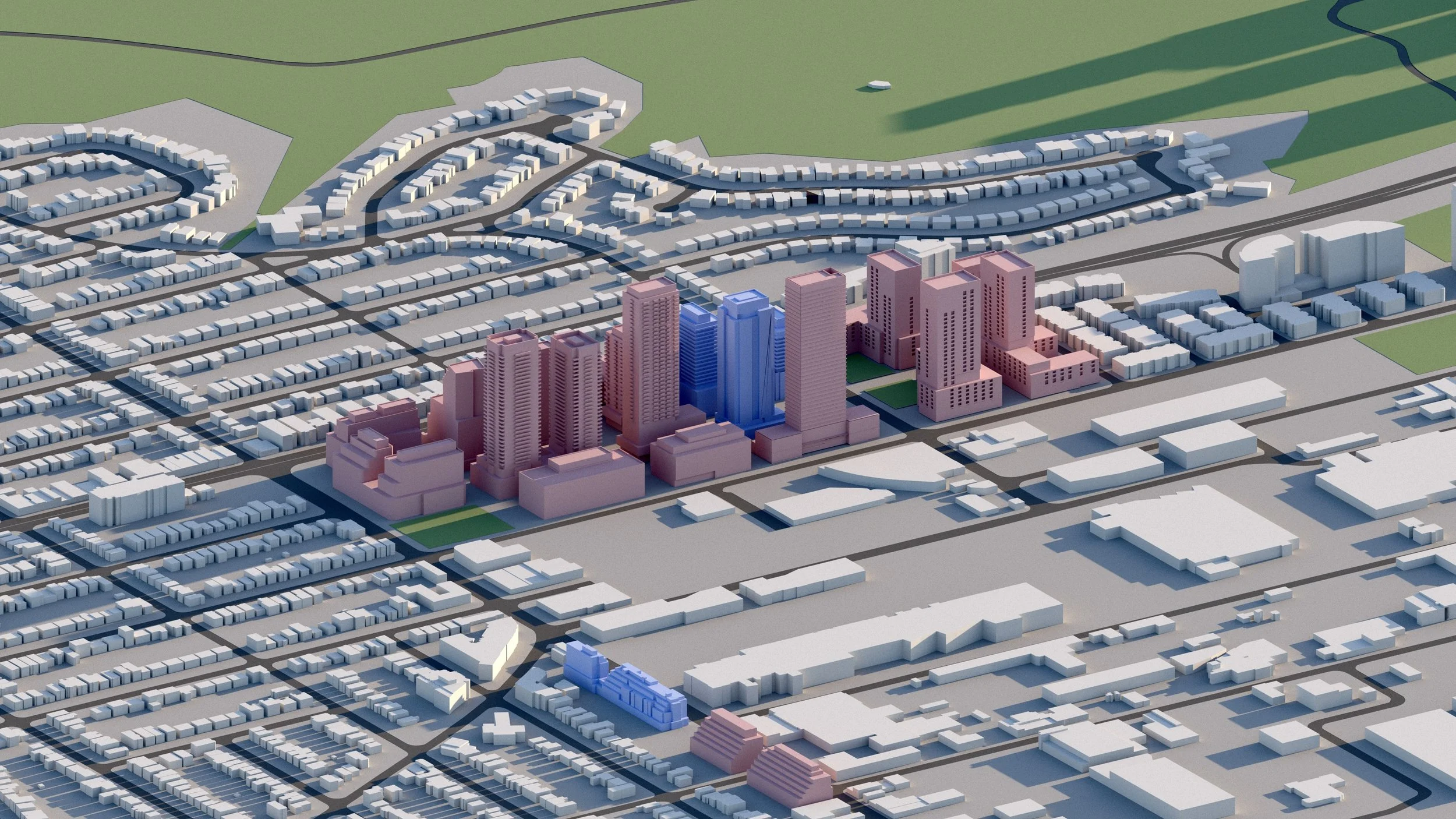
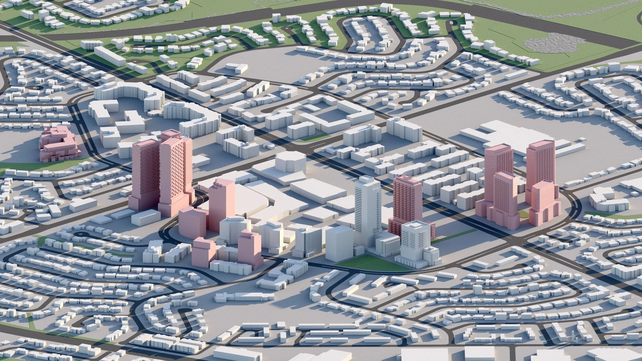
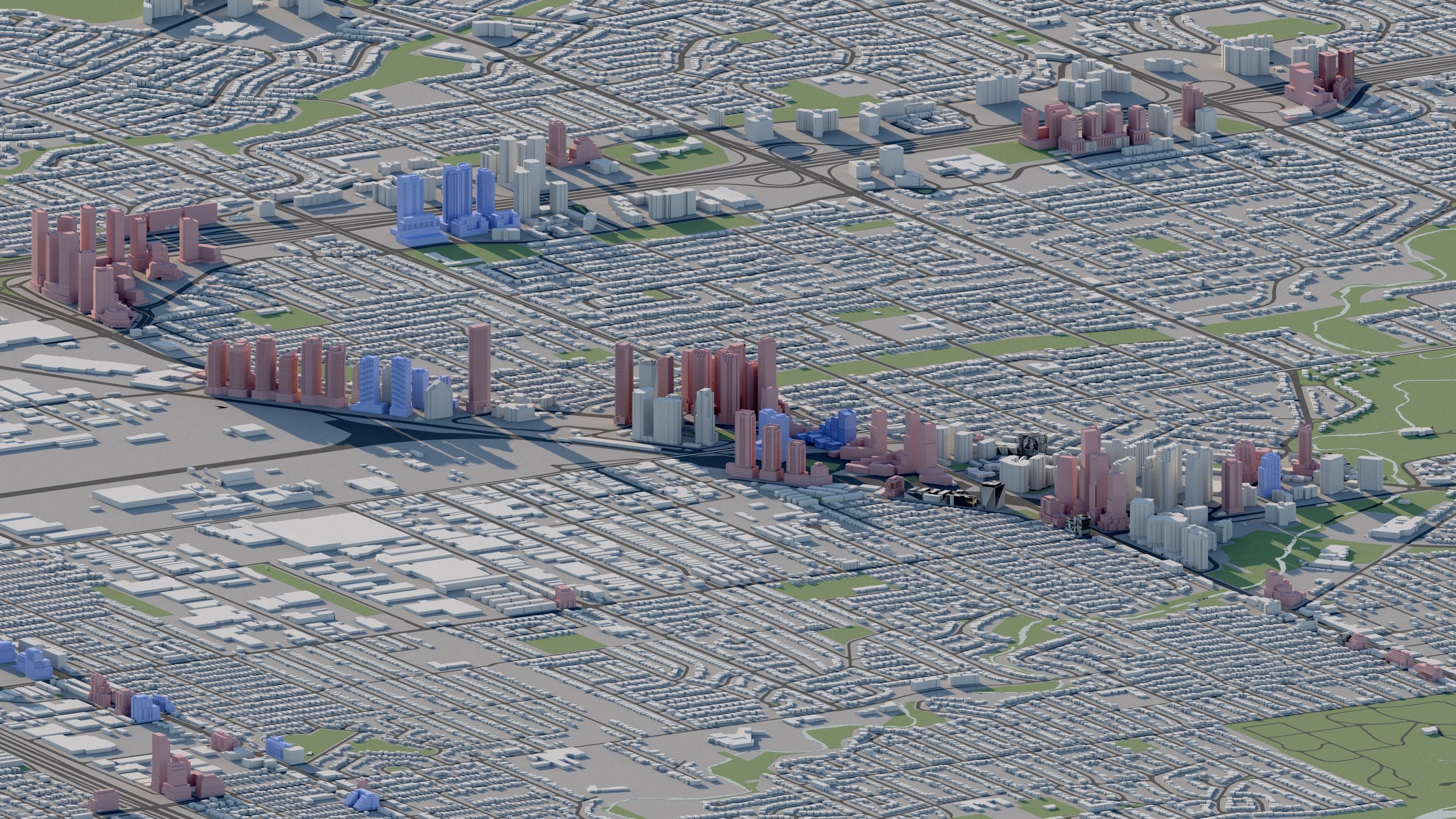
Yonge and St Clair
5,600+ RESIDENTIAL UNITS
Yonge and St Clair continues its vertical growth with more than 5,600 residential units planned and towers up to 52 storeys. The area is serviced by the St Clair Subway Station along TTC Line 1 and the 512 St Clair Streetcar.
-
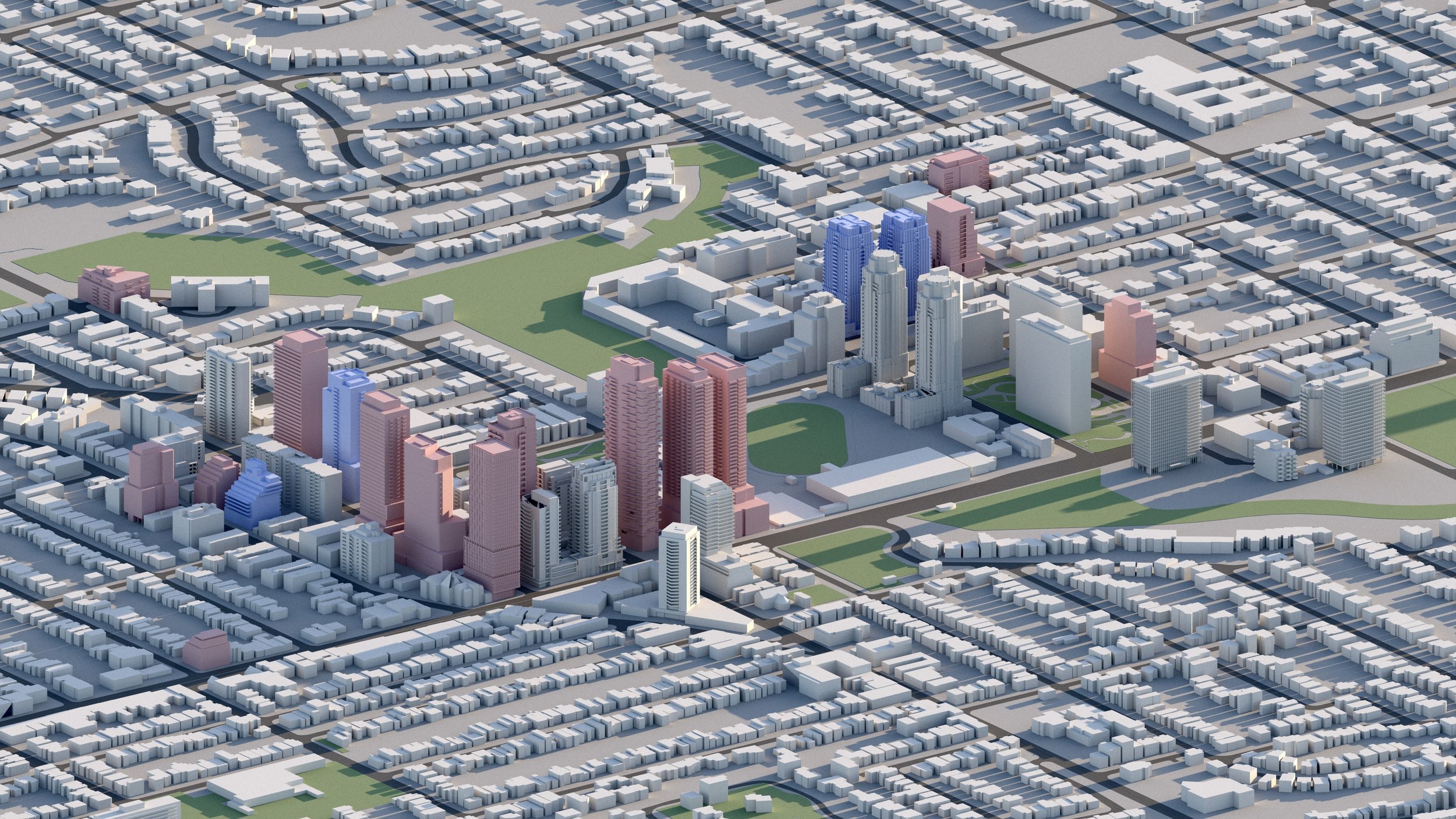
Avenue and St Clair
1,400+ RESIDENTIAL UNITS
Over 1,400 residential units are planned surrounding the Avenue Road and St Clair intersection, including towers up to 49 storeys.
-
Bathurst and St Clair
4,000+ RESIDENTIAL UNITS
Over 4,000 residential units are planned surrounding the Bathurst and St Clair intersection. The area is serviced by St Clair West subway station along TTC Line 1.

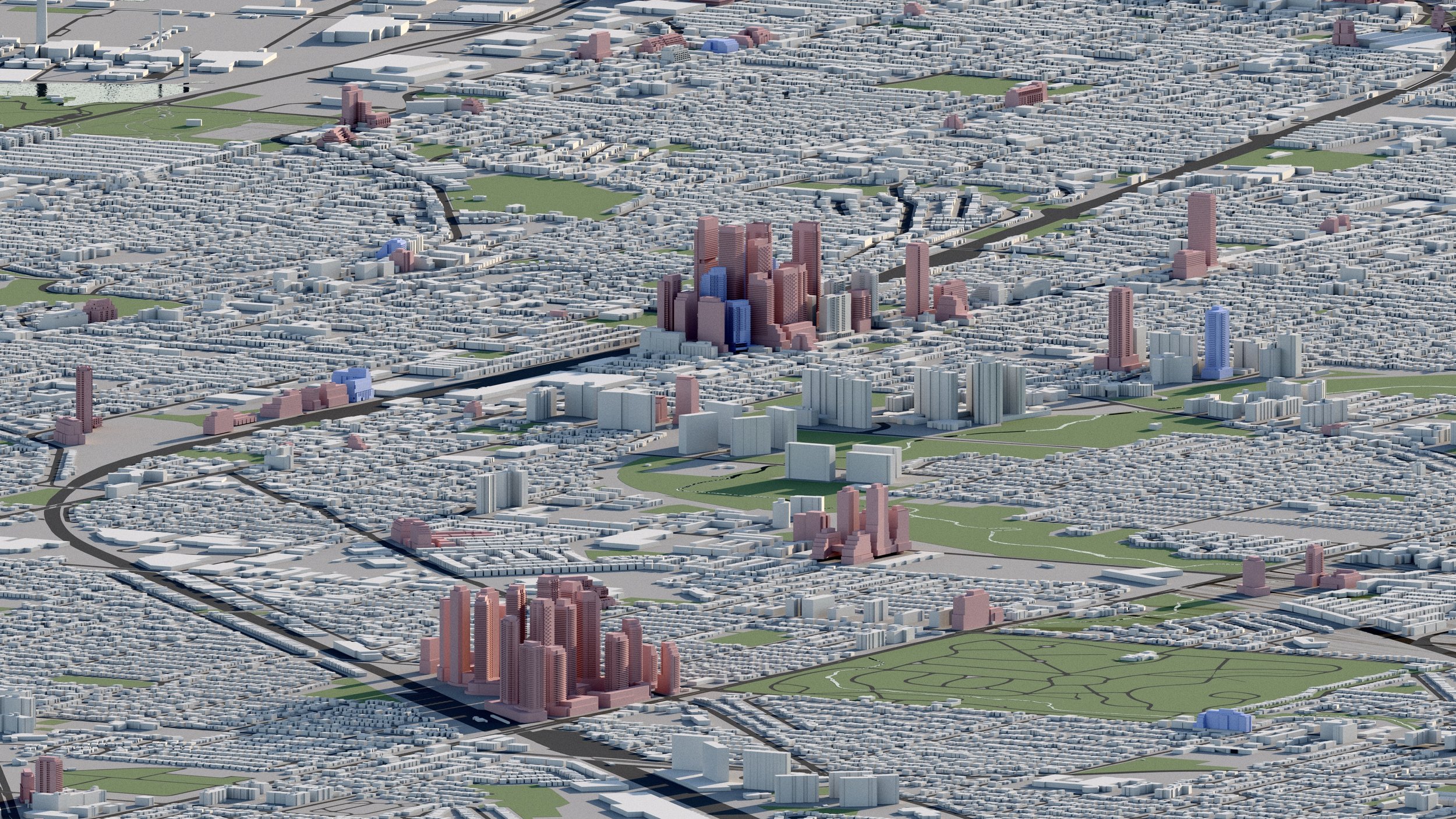
The Eglinton Crosstown LRT has transformed Eglinton Avenue into one of Toronto’s key transit corridors. Entering service in 2024, the rapid transit line has been the catalyst for dozens of new developments along sections of its route.
Eglinton Crosstown LRT
-
Mount Pleasant and Eglinton
3,500+ RESIDENTIAL UNITS
Nearly 3,500 residential units are proposed within 300 metres of the Mount Pleasant and Eglinton intersection, ahead of a future station along the Eglinton Crosstown LRT.
-
Bayview and Eglinton
5,000+ RESIDENTIAL UNITS
There are now more than 5,000 residential units proposed within a 300 metre radius of the Bayview and Eglinton intersection, including towers up to 46 storeys.
-
Eglinton and Laird
5,700+ RESIDENTIAL UNITS
More than 5,700 residential units are planned surrounding Laird Station along the Eglinton Crosstown LRT, including towers up to 40 storeys.
-
Don Mills and Eglinton
20,000+ RESIDENTIAL UNITS
Over 20,000 residential units are planned surrounding the Don Mills and Eglinton intersection, and an additional 10,000+ further east along the Don Valley Parkway. More than 40 high-rises are in development in the area, soon to be serviced by the Eglinton Crosstown LRT and Ontario Line at Don Valley (formerly Science Centre) Station.
-
Don Mills and Lawrence
3,700+ RESIDENTIAL UNITS
Over 3,700 residential units are planned surrounding the Don Mills and Lawrence intersection, including towers up to 34 storeys.
-
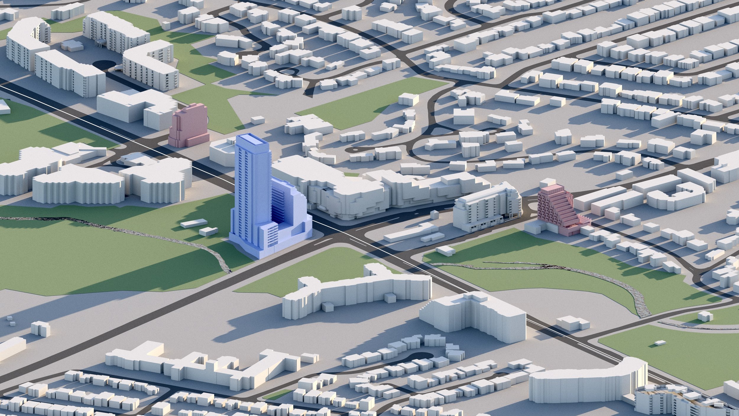
Yonge and Yorkmills
800+ RESIDENTIAL UNITS
Approximately 800 residential units are planned for the Yonge and Yorkmills neighbourhood, including towers up to 32 storeys.
Explore the city
Downtown
Midtown

North York

Scarborough
Etobicoke
East York
West Toronto