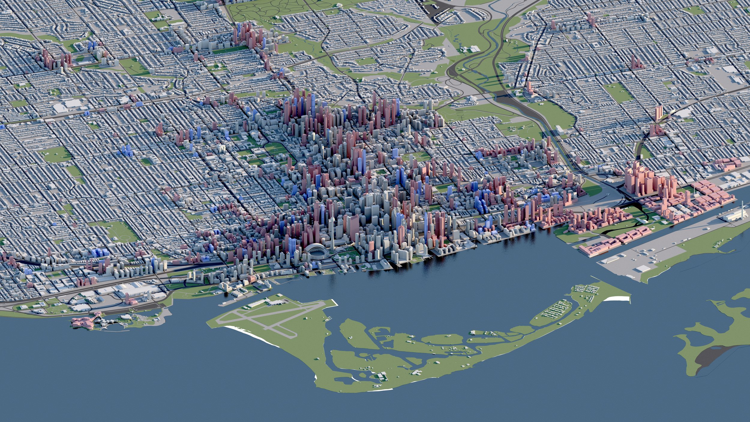
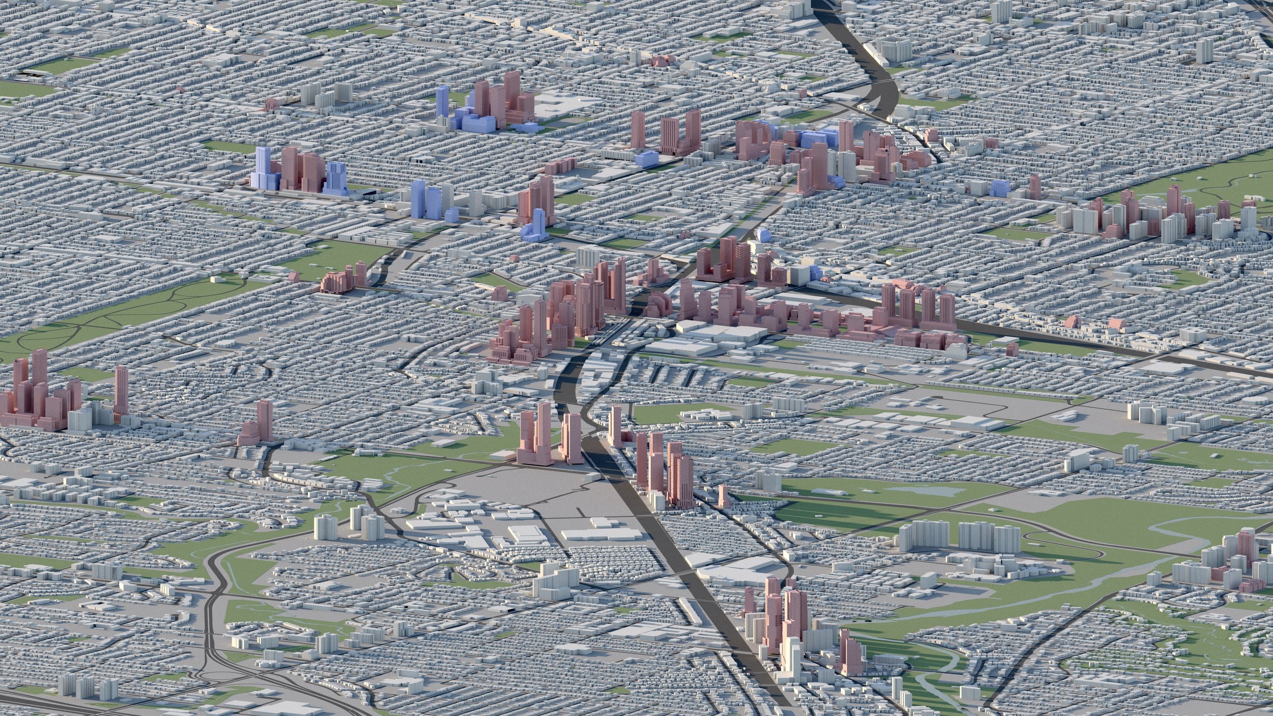
North York
Under Construction
Proposed / Approved
Water
Roads
Existing
Parks
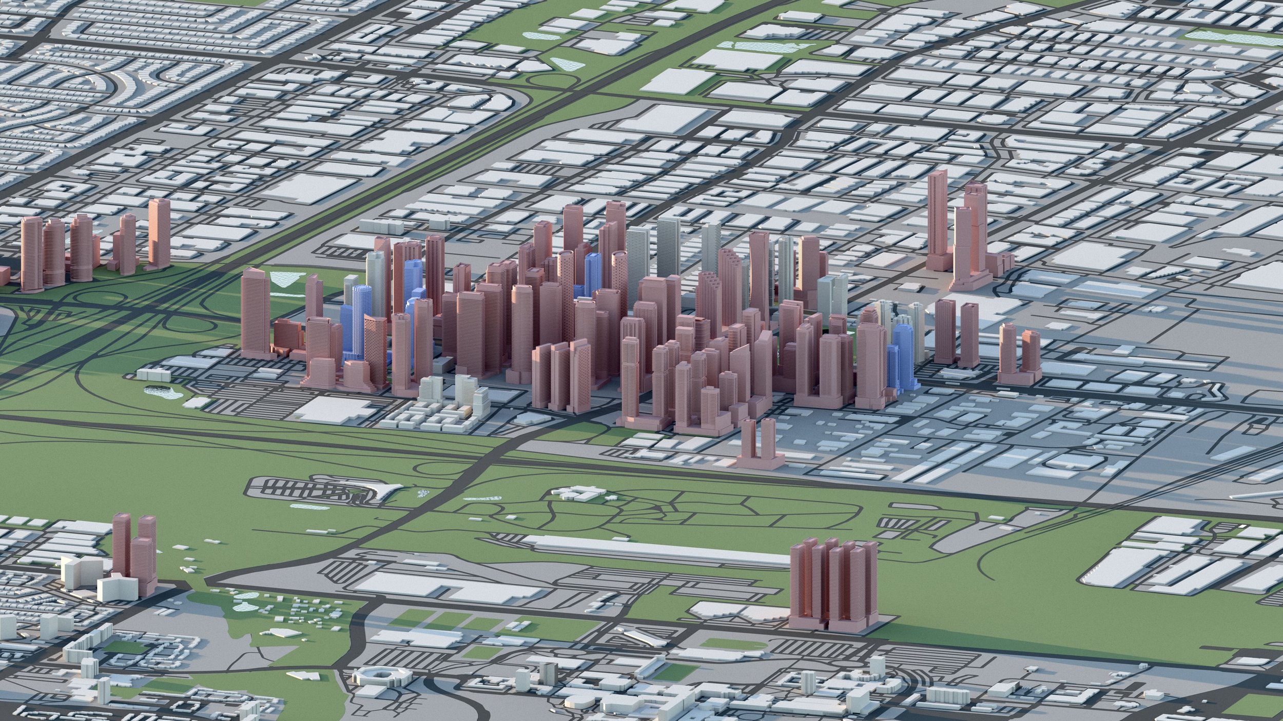
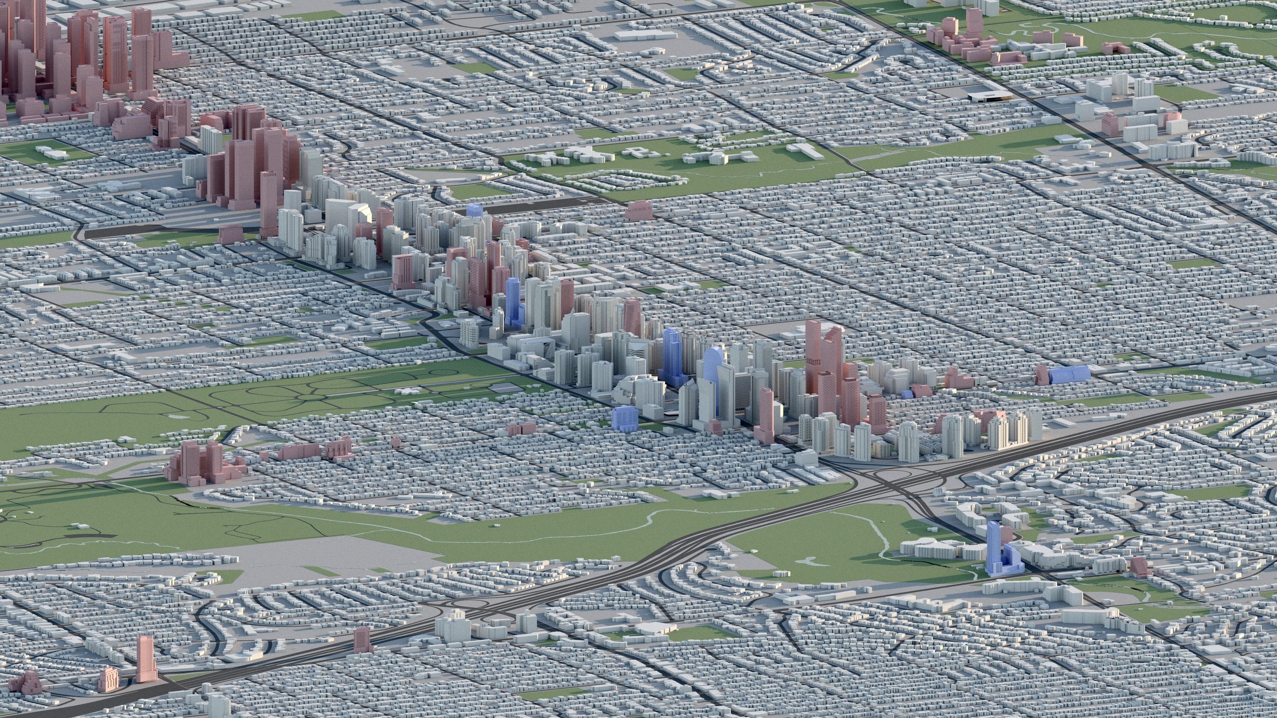
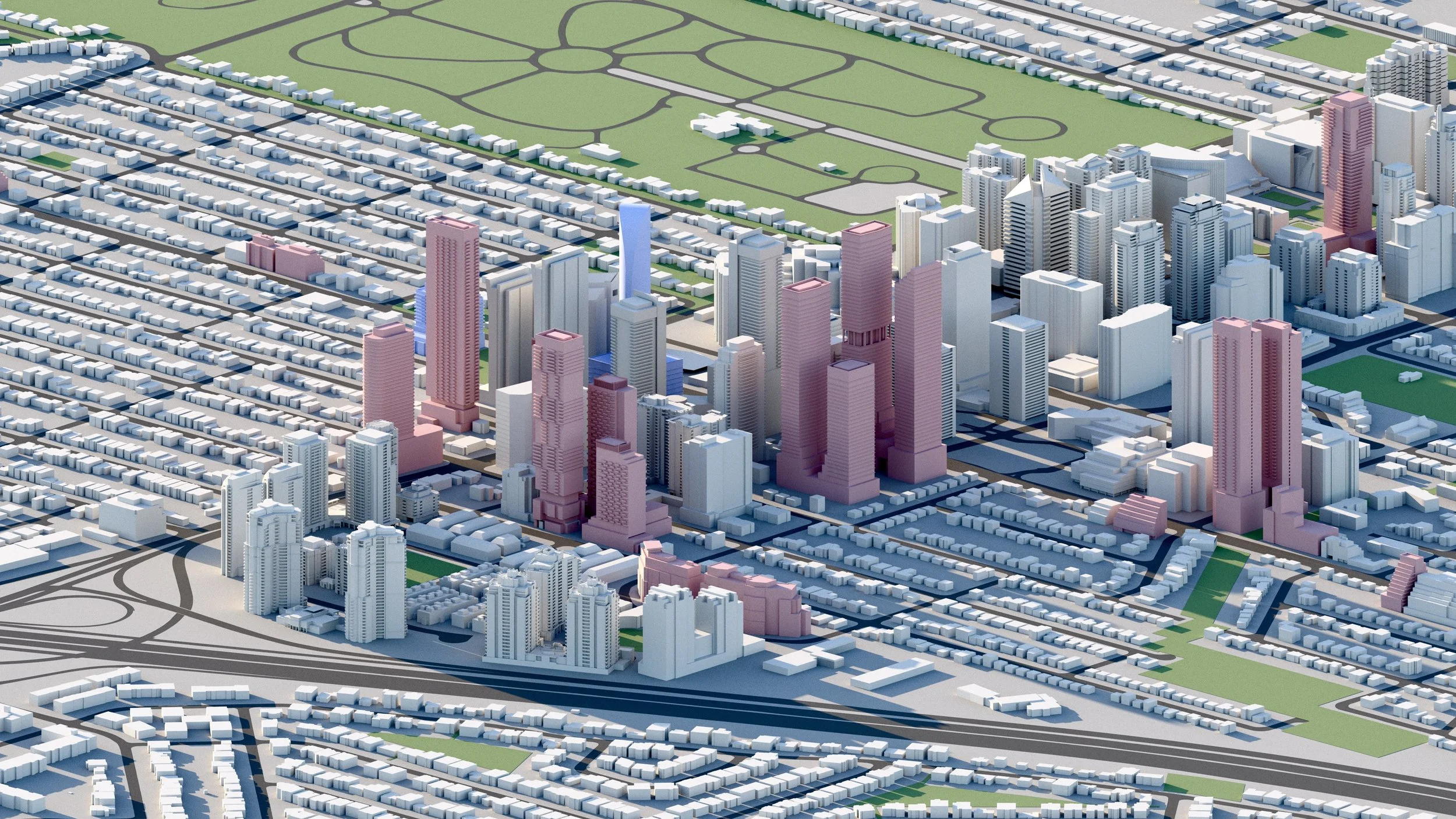
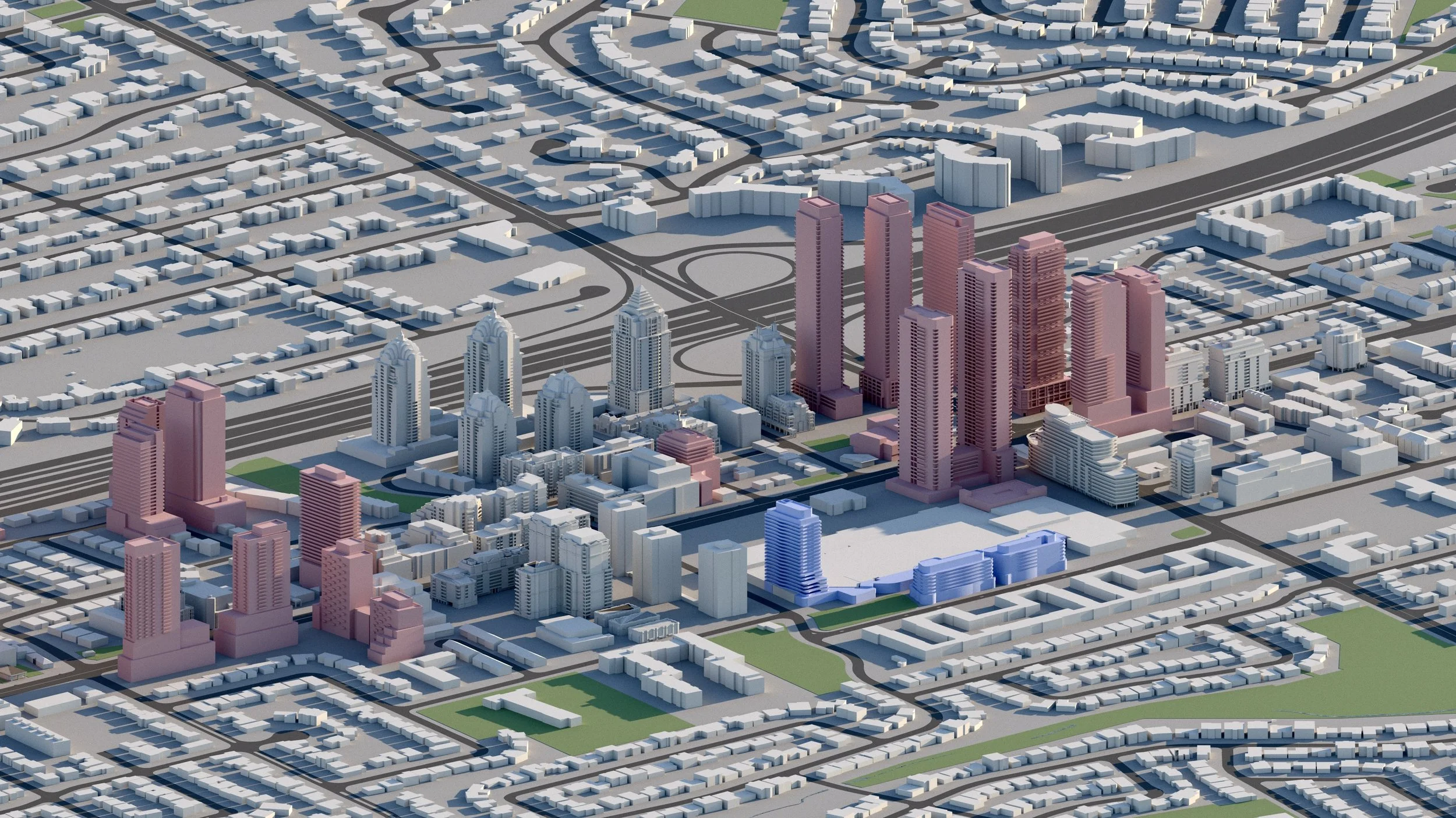
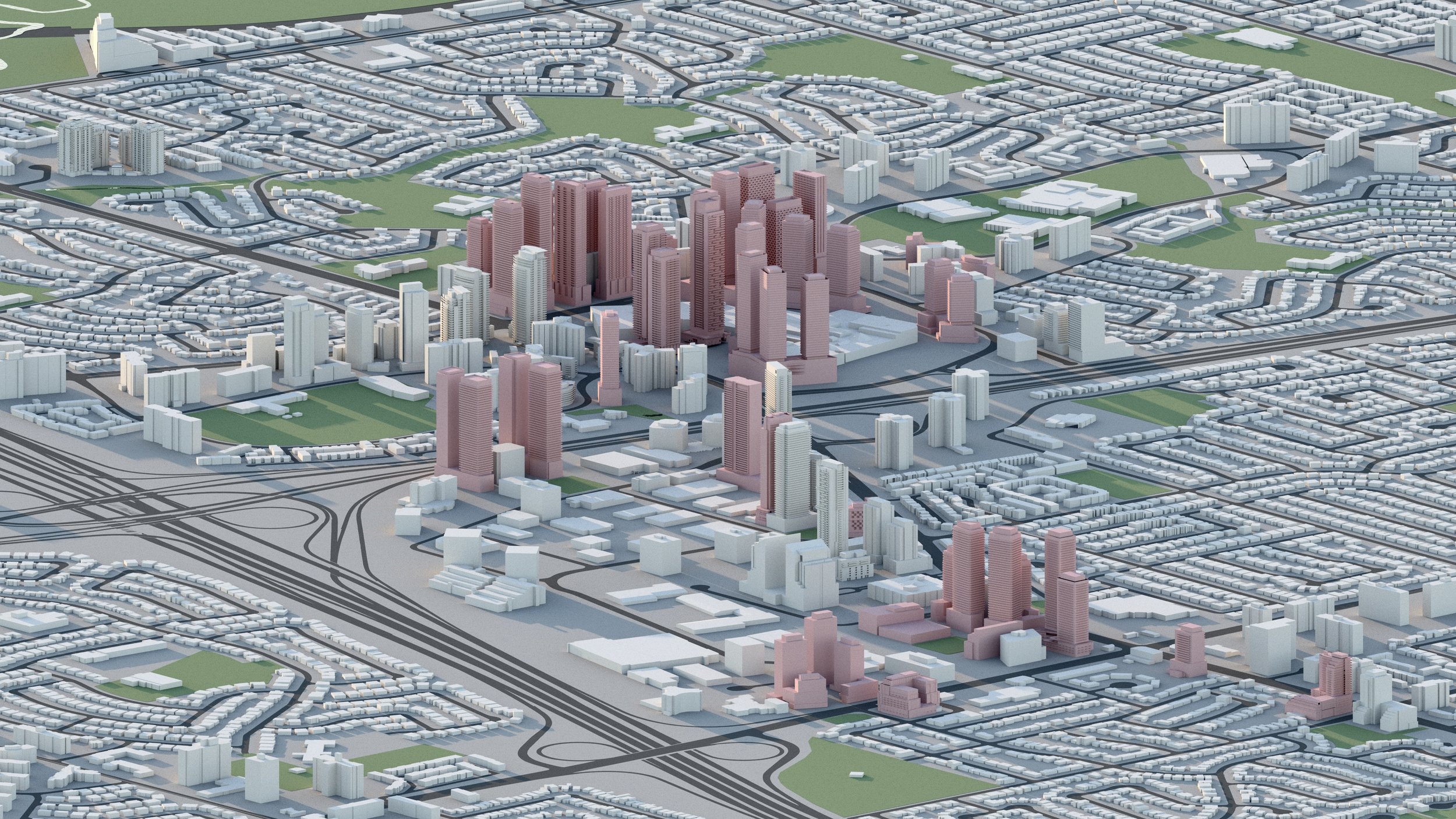
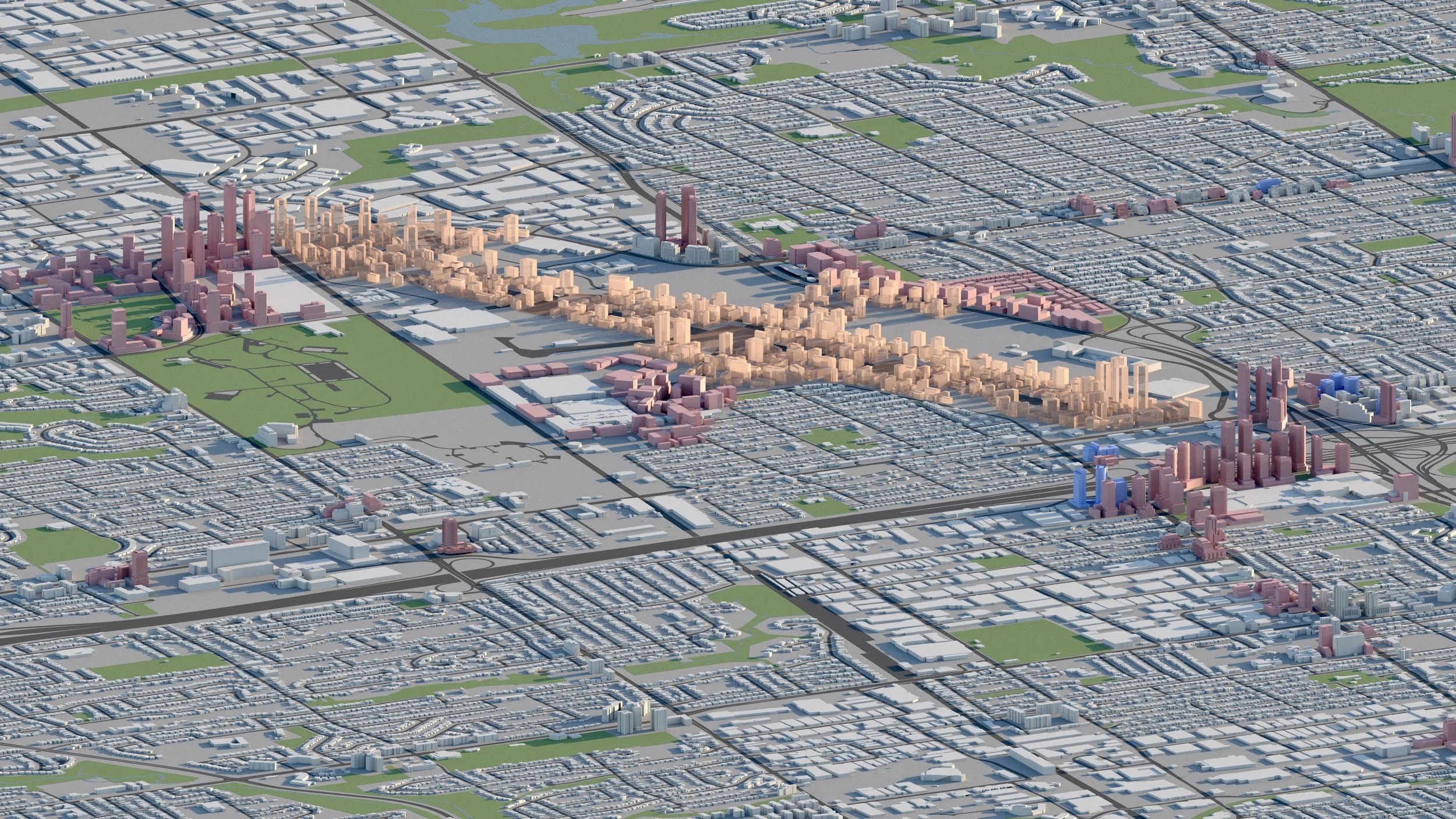
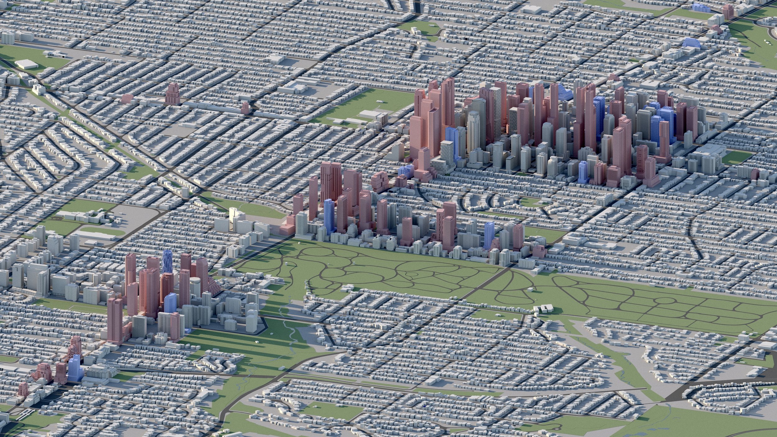
North York City Centre
Centred along Yonge Street, North York City Centre’s linear skyline is about to double in length, extending density to Steeles Avenue, with a wave of high-rise development proposed ahead of the Yonge North Subway Extension.
The area is largest employment centre outside of Downtown Toronto.
-
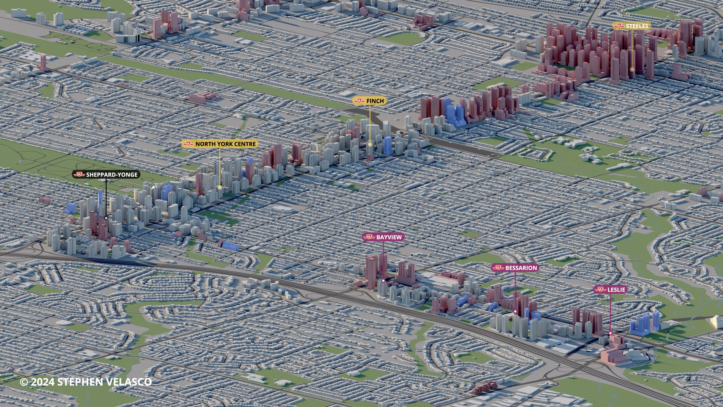
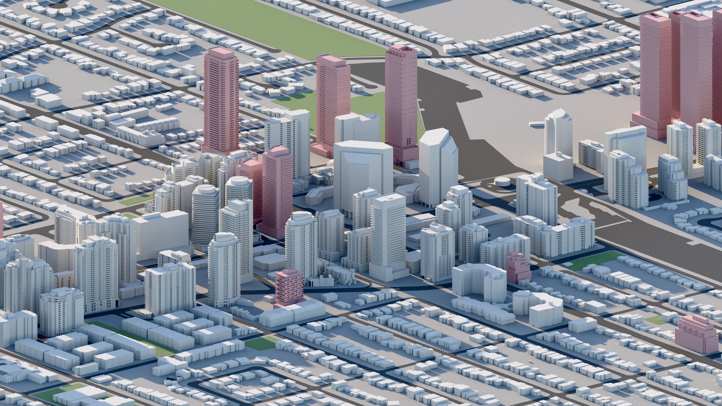
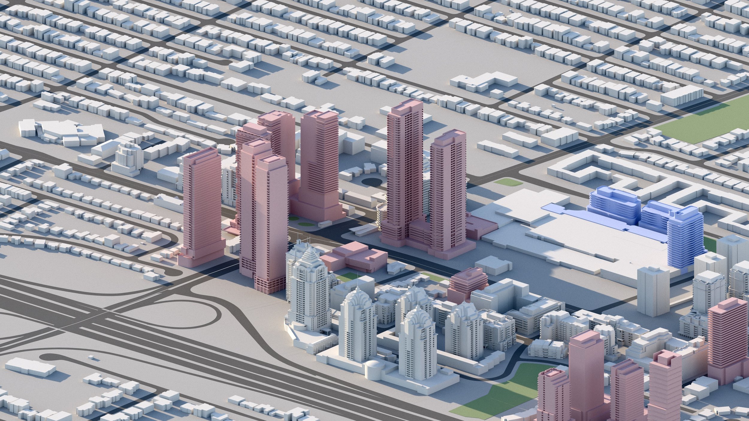
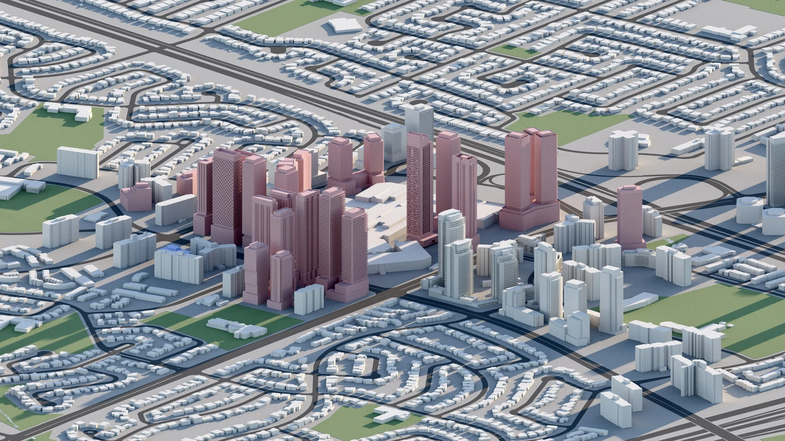
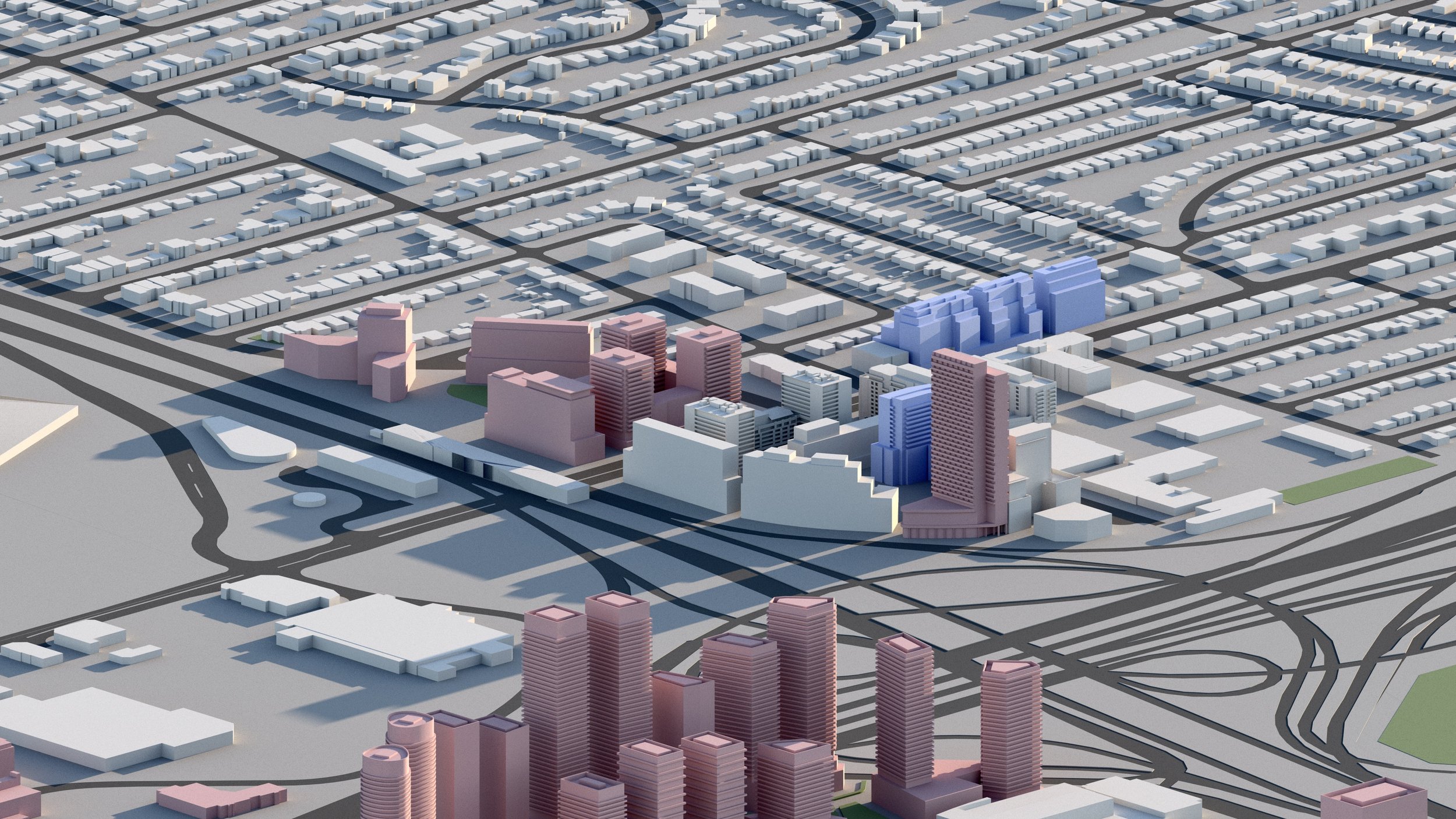
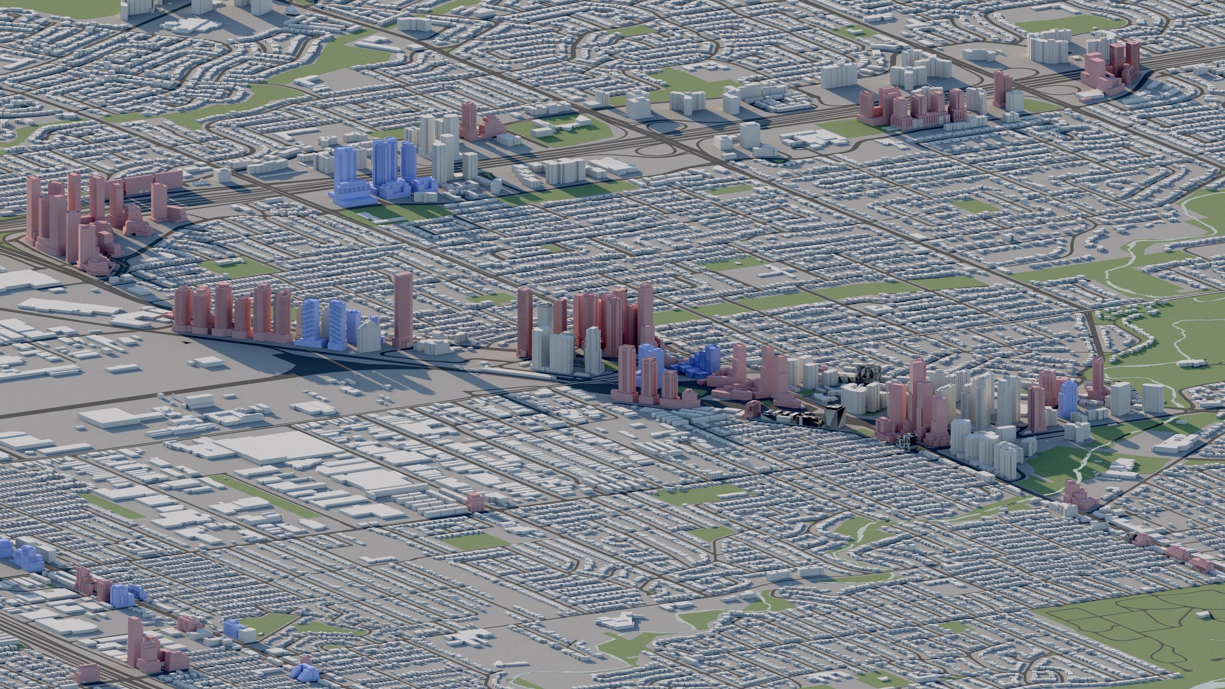
Yonge and Sheppard
4,200+ RESIDENTIAL UNITS
Over 4,200 residential units are planned surrounding the Sheppard-Yonge intersection including towers up to 59 storeys.
-
Yonge and Finch
2,500+ RESIDENTIAL UNITS
Approximately 2,500 residential units are planned surrounding the Yonge and Finch intersection in North York.
-
Yonge and Cummer
6,200+ RESIDENTIAL UNITS
More than 6,200 residential units are proposed or under construction within a 300m radius of the Yonge and Cummer/Drewry intersection.
-

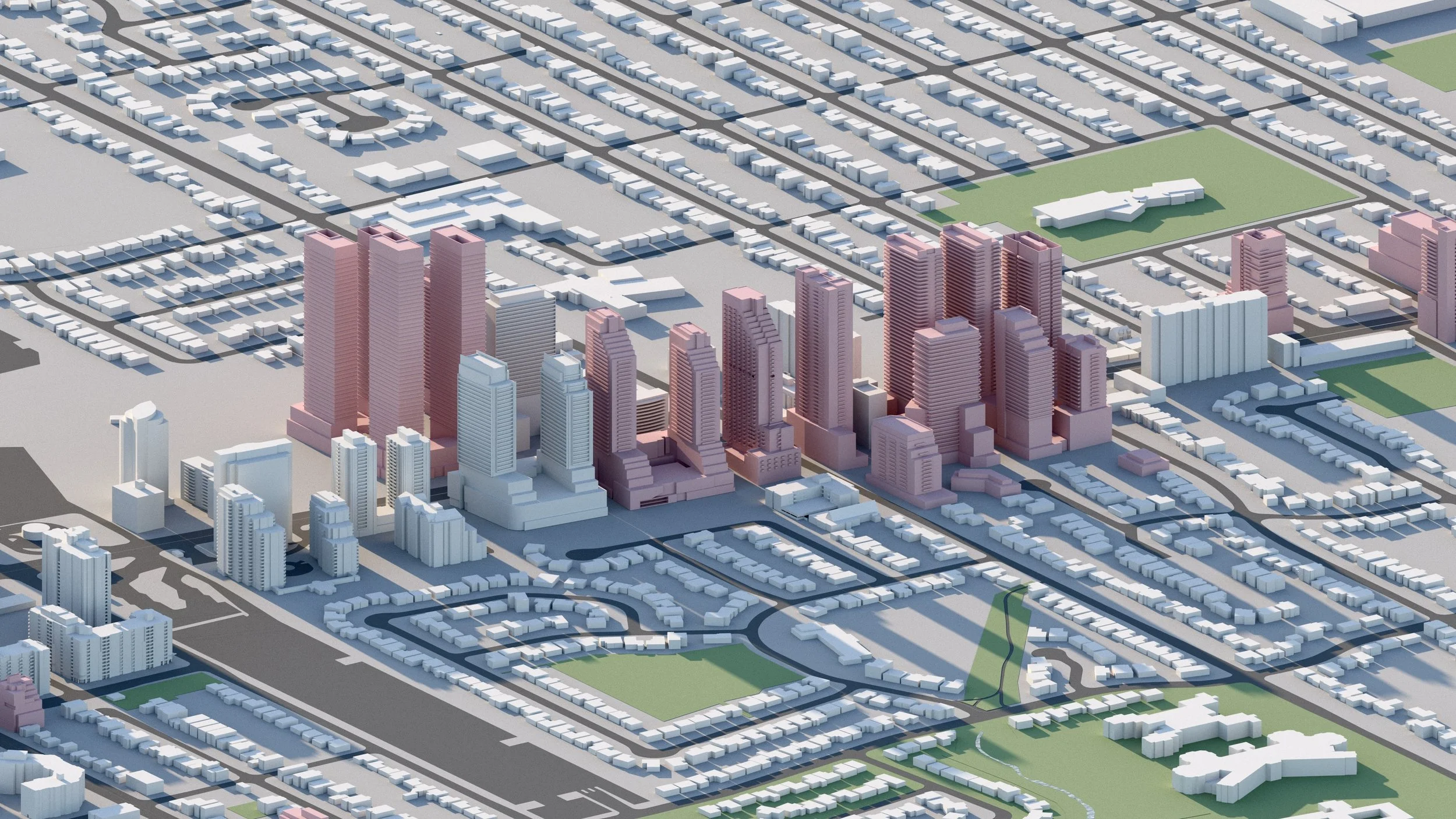
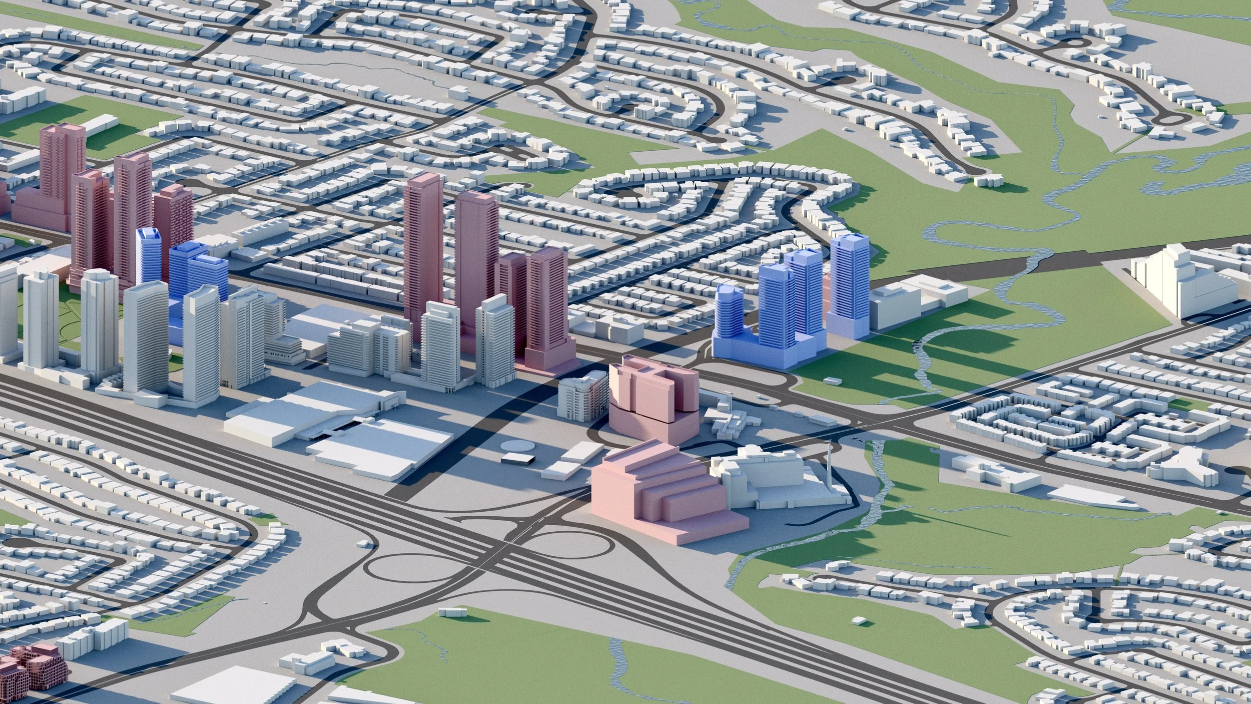
Yonge and Steeles
25,000+ RESIDENTIAL UNITS
Approximately 25,000 residential units proposed within a 700m radius of the Yonge and Steeles intersection, including towers up to 65 storeys. Existing strip malls and auto dealerships are set to be replaced by high-density development in one of the most dramatic urban transformations in all of Toronto.
-
Bathurst and Steeles
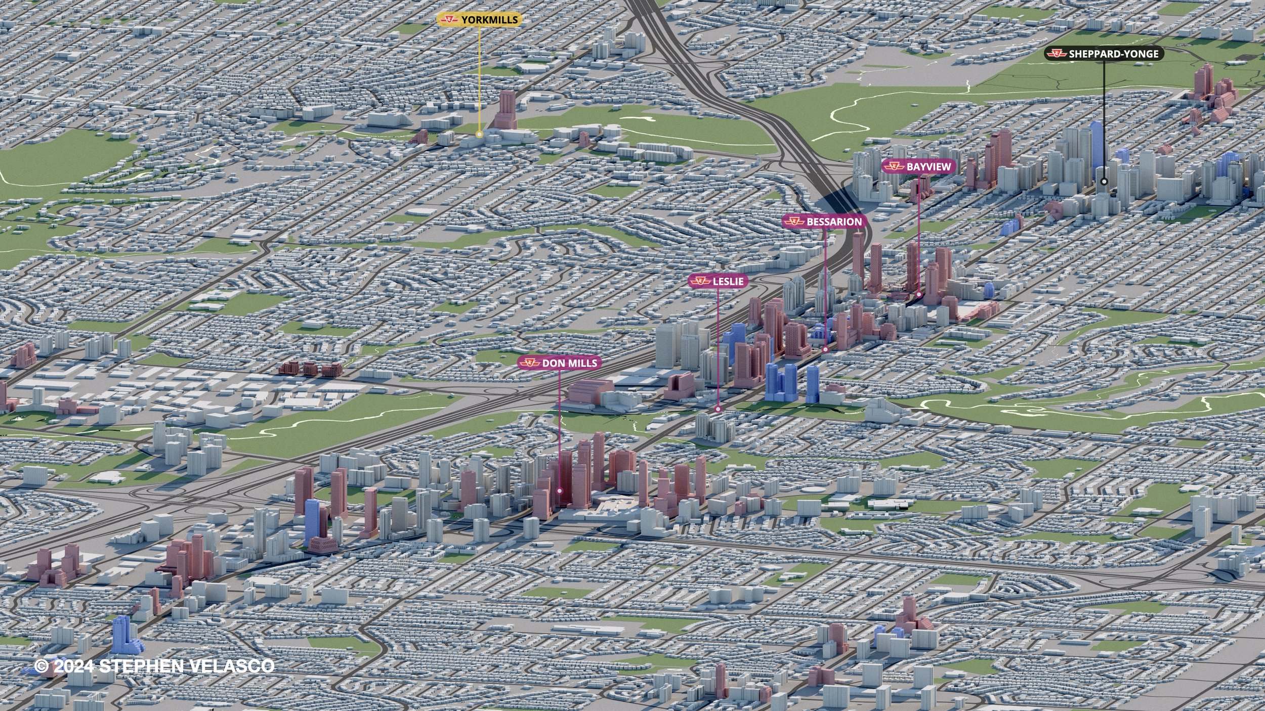
Line 4 Sheppard
20 Years after the construction of the Line 4 Sheppard subway, density is progressively being realized along sections of its route ahead of a potential extension into Scarborough.
-
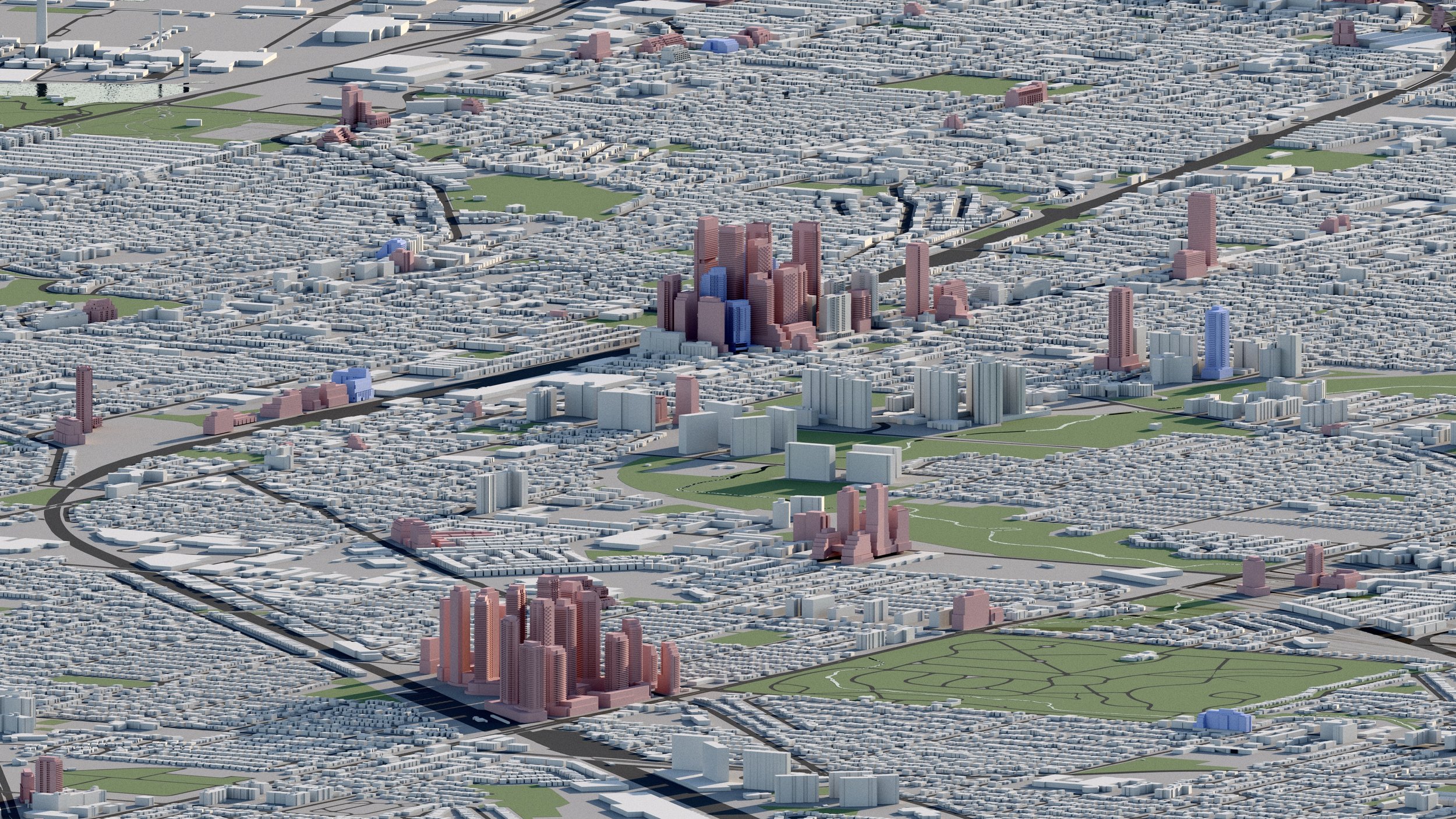
Bayview and Sheppard
4,000+ RESIDENTIAL UNITS
Over 4,000 residential units are in development within surrounding the Bayview and Sheppard intersection, including towers up to 48 storeys. -
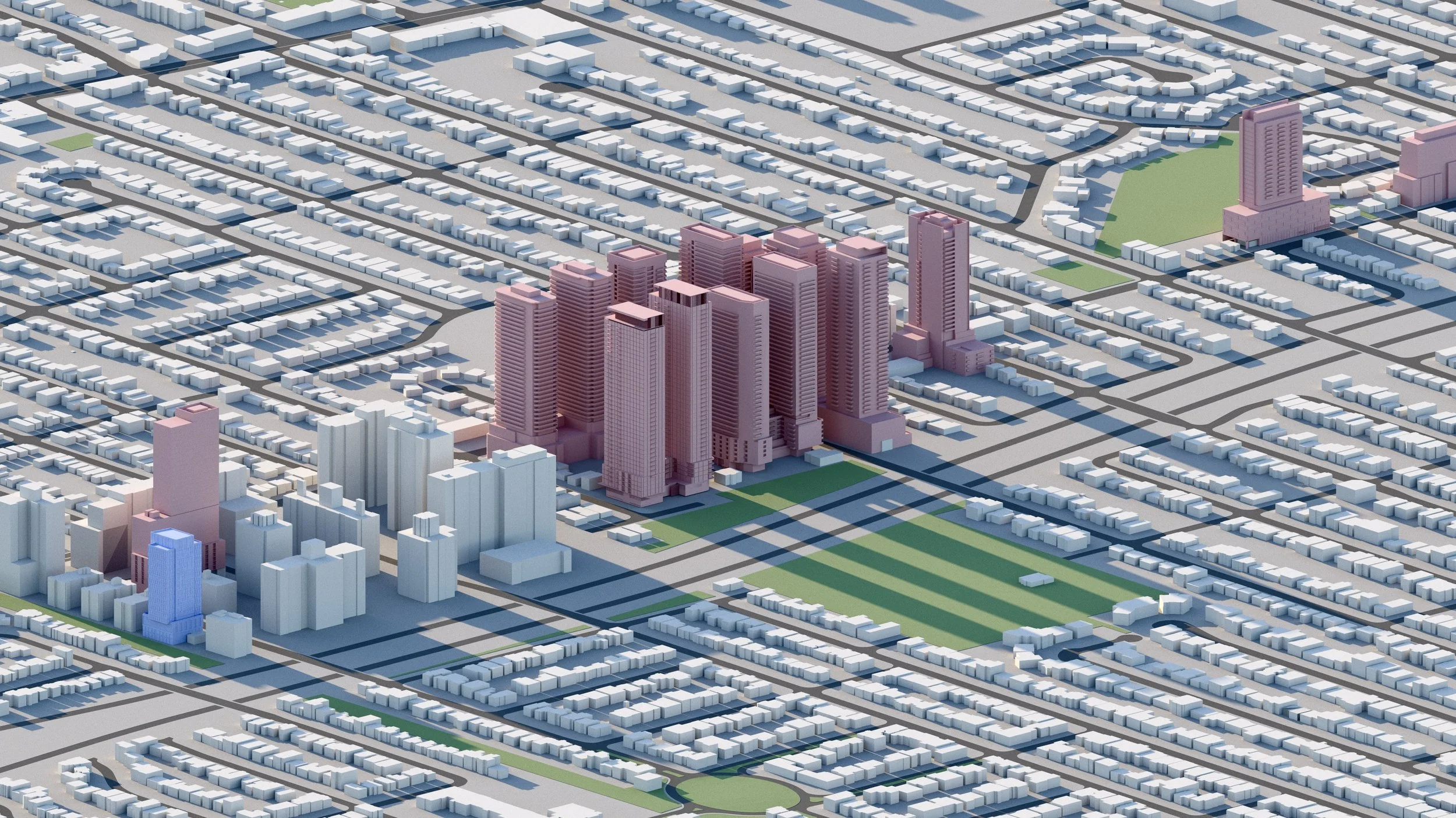
Bessarion
5,500+ RESIDENTIAL UNITS
More than 5,500 residential units are planned surrounding Bessarion Station, including towers up to 44 storeys.
-
Leslie and Sheppard
3,500+ RESIDENTIAL UNITS
More than 3,500 residential units are planned surrounding the Leslie and Sheppard intersection, including towers up to 52 storeys. The area is served by nearby Leslie Station and Oriole GO Station.
-
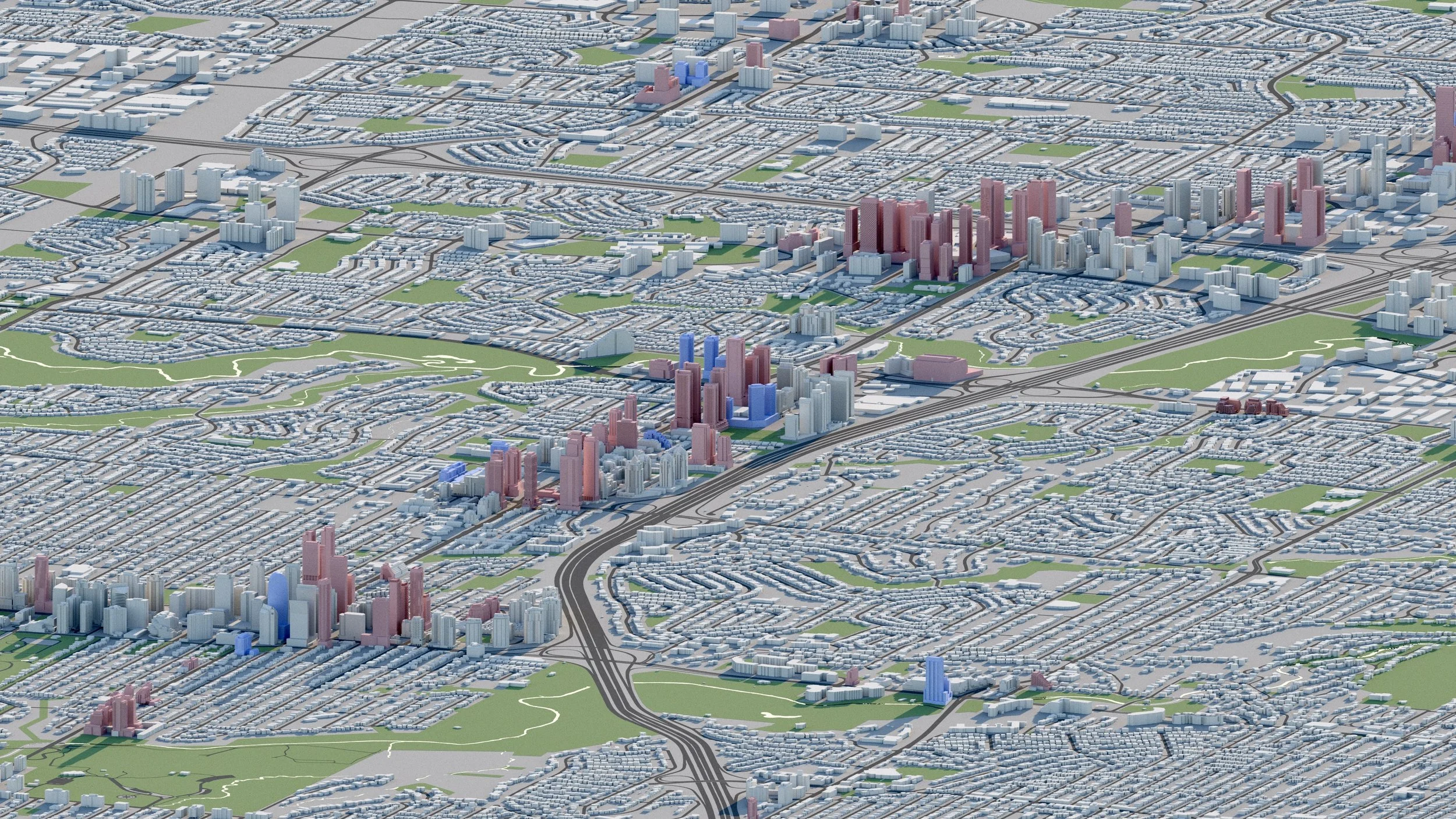
Don Mills and Sheppard
11,500+ RESIDENTIAL UNITS
Over 11,500 residential units are planned surrounding the Don Mills and Sheppard intersection, including towers up to 52 storeys.
-

Victoria Park and Sheppard
4,800+ RESIDENTIAL UNITS
Approximately 4,800 residential units are planned surrounding the Victoria Park and Sheppard intersection, including towers up to 45 storeys.
-
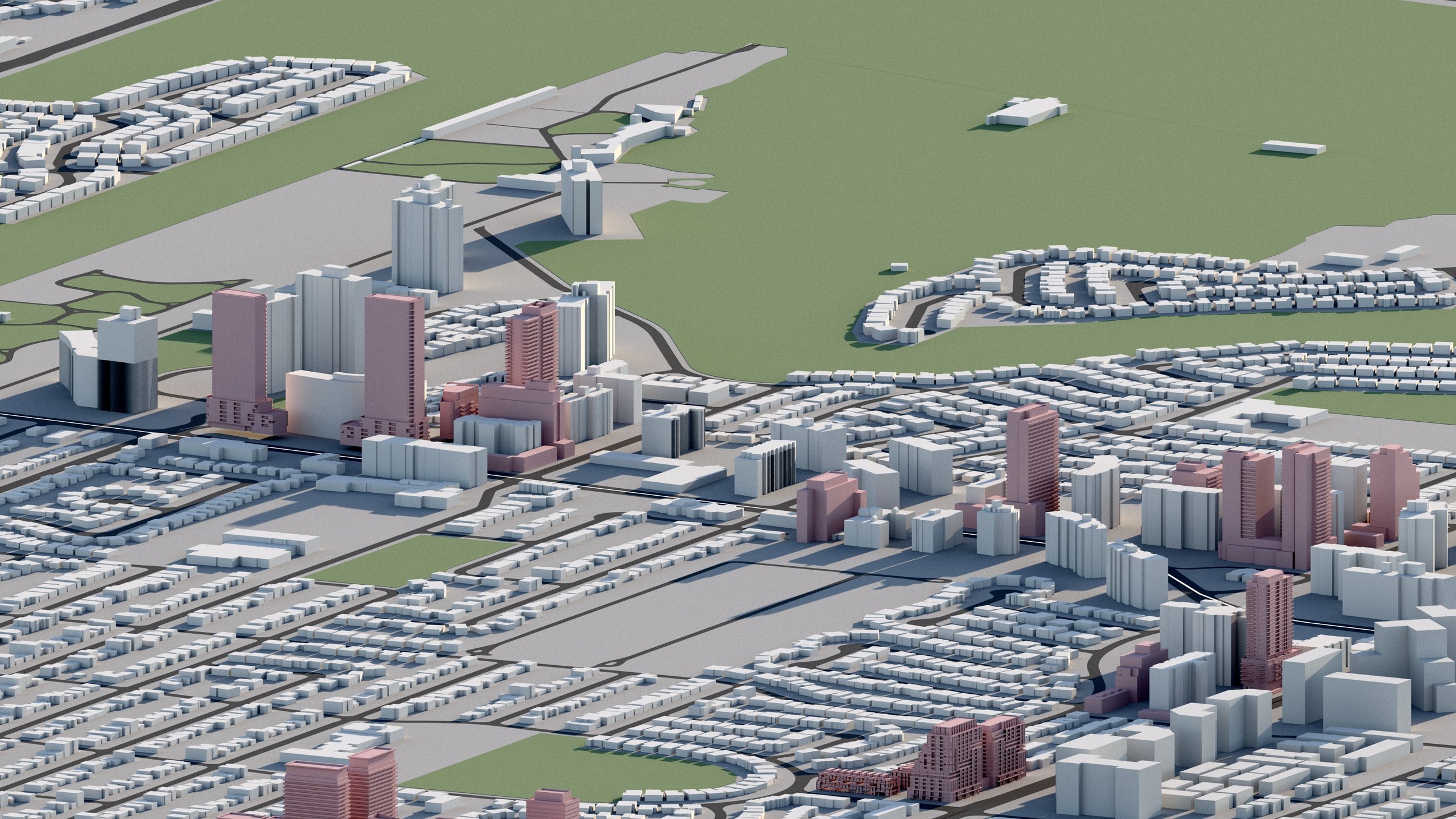
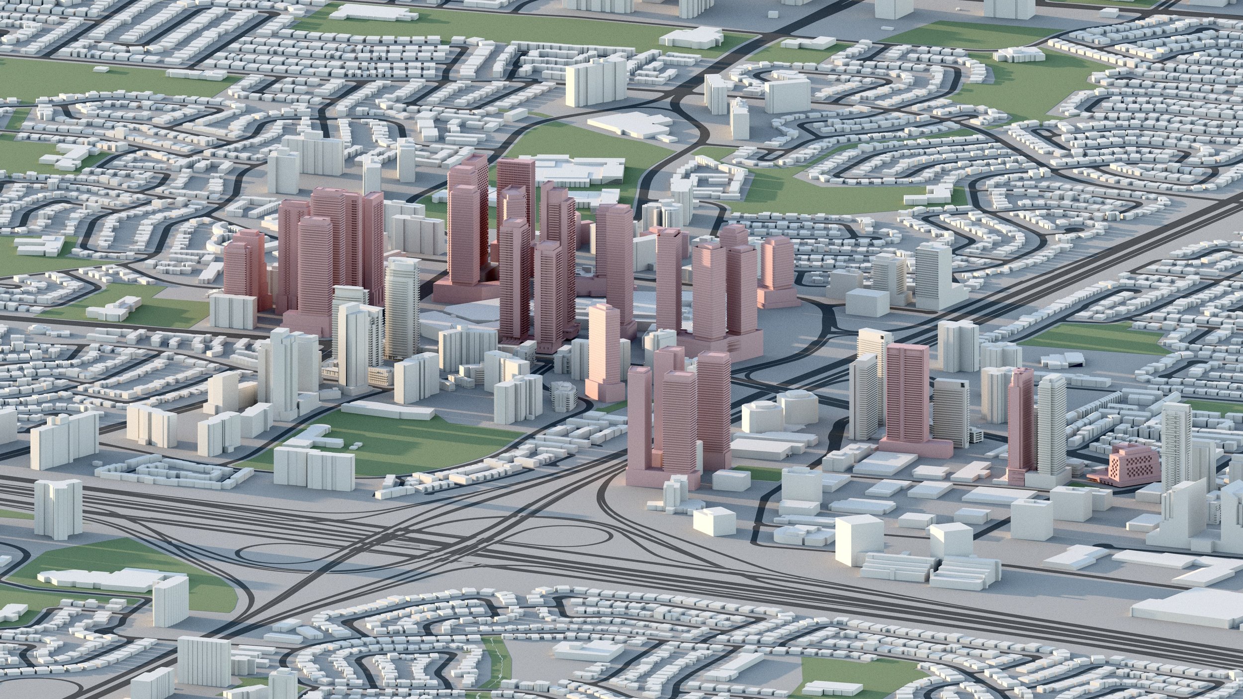
Downsview
80,000+ RESIDENTIAL UNITS
Over 80,000 residential units are planned for Downsview, anchored by the YZD masterplan on the former Downsview Airport lands. -

Sheppard West
2,100+ RESIDENTIAL UNITS
Over 2,100 residential units are planned or under construction surrounding Sheppard West Station, including towers up to 55 storeys.
-
Wilson Station
3,100+ RESIDENTIAL UNITS
Over 3,100 residential units are planned surrounding Wilson subway station, including towers up to 34 storeys.
-

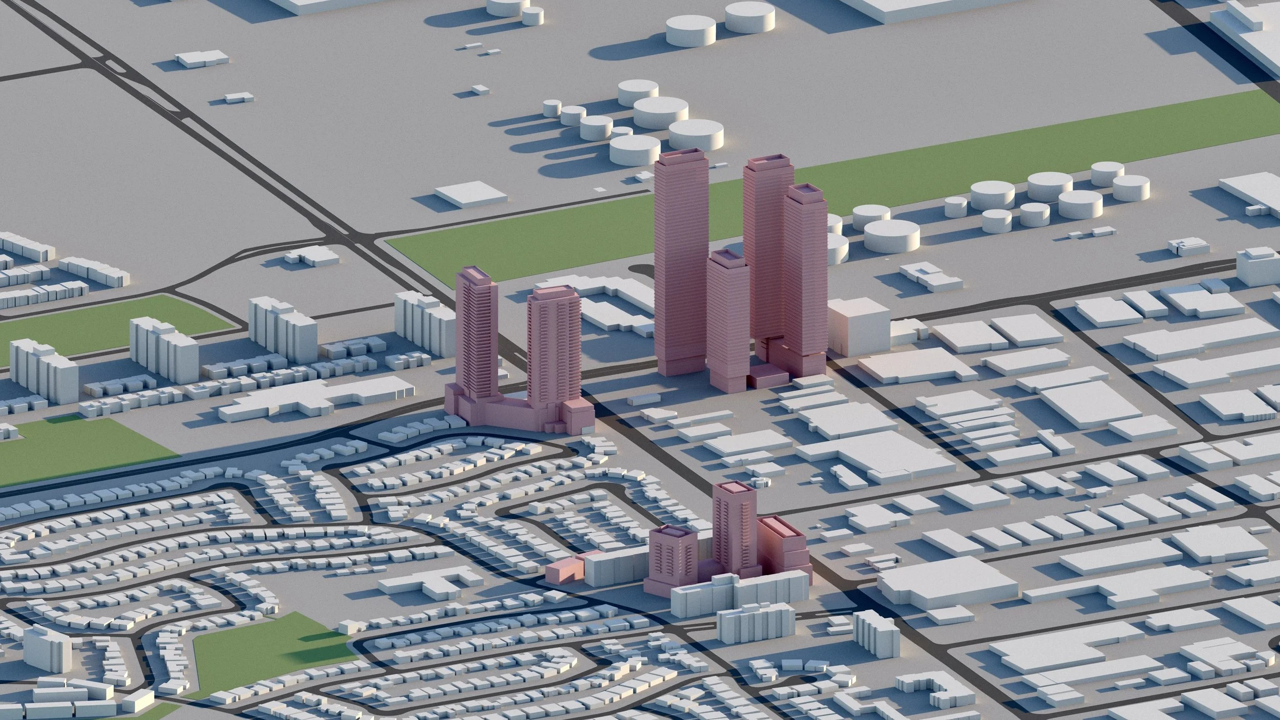
Yorkdale / Allen Rd-Highway 401
13,000+ RESIDENTIAL UNITS
Over 13,000 residential units are in development surrounding Yorkdale Mall and the Dufferin-Lawrence intersection.
-
Allen Road / Marlee Ave
6,700+ RESIDENTIAL UNITS
Approximately 6,700 residential units are planned along Marlee Ave between Eglinton and Lawrence Ave West in North York, including towers up to 40 storeys.

Finch West LRT
Height and density emerges along the recently com TTC Line 6 - Finch West LRT.
-
Keele and Finch
3,000+ RESIDENTIAL UNITS
Approximately 3,000 residential units are planned surrounding Finch West Station at the Keele and Finch intersection, including towers up to 61 storeys. -

Jane and Finch
4,400+ RESIDENTIAL UNITS
Towers up to 50 storeys are proposed in the immediate area, including more than 4,400 residential units. -

Weston and Finch
5,100 RESIDENTIAL UNITS
Approximately 5,100 residential units are planned surrounding the Finch and Weston intersection, including towers up to 55 storeys — one of several development hotspot along the future Finch West LRT.
Explore the city
Downtown
Midtown

North York

Scarborough
Etobicoke
East York
West Toronto